寻找西北通道
图/文/胡凌云
作为Rush乐队的乐迷,我知道Neil Peart所著的Ghost Rider: Travels on the Healing Road已经很多年,但直到今年三月才拿起——我和作者一样,因为失去了亲人而准备上路。而我也并没有读完它——读了几十页之后已经上路去访问阿尔卑斯群峰了,而且,读过开头,已经能和作者感同身受,找到自己渴望旅行背后的深沉动机。
欧洲土地毕竟是陌生的异国,亲人的形象伴随的是漫长的乡土记忆。也许是这种记忆在潜意识中的召唤,我发现自己比以往更加迷恋那些消逝的巨大文明。第一个不需要守在病床前的假期,从童年到入境对道路和出口的向往, 把我推上了西北通道——我在现实中从未走通,而只能跨洋绕行的一段荒城之路。
Been a fan of Canadian band Rush, I knew about the book Ghost Rider: Travels on the Healing Road, written by its drummer and lyricist Neil Peart, for quite a while. Eventually, I picked it up this spring, when I prepared to hit the road after loss of a loved one, just like the author did. But I stopped reading after a couple of pages as I went on to visit the majestic Swiss Alps. By then, I have received full resonance in from the text, located the secret power behind my desire for travel and utilized it for the reconstruction of my life.
The landscape of Europe, however, could hardly connect my memory from the past, which I feel like a diminished ancient civilization. The Silk Road used to be my dreaming path to explore when I was a kid, and it finally resurfaced and landed on my itinerary. There are many reasons for this, but the keywords would be, again, travel and connection.
下图为主要行程路线(Google Map 链接)。罗中镇在Google地图上无法搜到,只能用坐标代替。汉长城与河仓城因无法找到地图路线而忽略。
The following is the map of my major route ( click Google Map for more info and interaction) . The town of Lop Nor cannot be found on Google Map so I had to use coordinates. Routes to the Great Wall of the Han Dynasty and Hecang Ruins cannot be established by the map and they are not presented in the map.
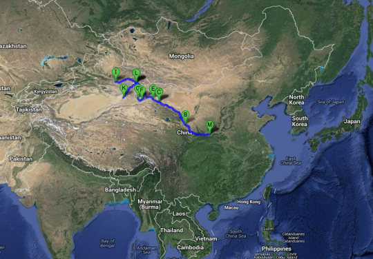
注:因为页面上有多达17个视频,为避免网络资源不足,都没有设置预加载,请点击播放按钮。绝大多数视频都是漫长的公路景象。又注:因为涉及的历史和地理内容均属国民常识,故配文说明比较简单,需要补课者可参照英文配文中的维基百科和卫星地图链接。日记式写法,错讹难免,欢迎指正。
Note:due to the large number of videos embedded into this page, they are not preloaded in order to preserve your network resource. Please click play button to view. Most of them are lengthy, monotonous road scenes. I provide many web links on the names, places, satellite maps etc, those are much worthy to click.
DAY 1 :西安-永登 (Xi’an – Yongdeng, 710km )
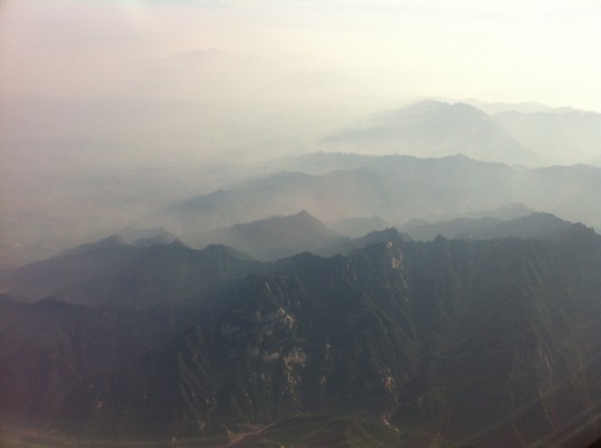
航班在西安降落前半小时航向突然从东北转向西北偏西,一丛巨大的山峦从眼前驶过。华山诸峰应该就在其中。在我能打开手机拍下这张照片之前,最雄奇的那些巅峰已经过去了。
Moutains 150km east of Xi’an. Among them is Mount Hua, one of the Five Greatest Mountains. It took me some time to locate and boot my cell phone, so the best scene was already way out of this picture.
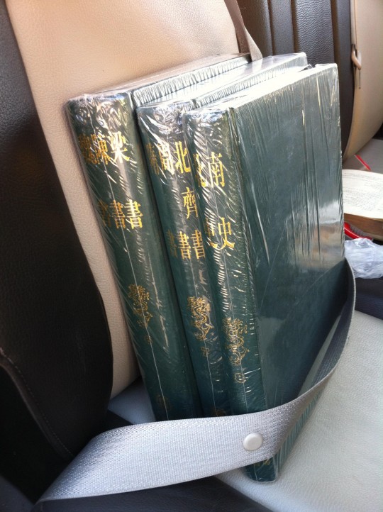
因为是返美前的旅行,带回的书籍也得跟着我到西北转一圈,其中包括三年还没搬完的二十四史。因为每晚都要住店,而且会有路段颠簸剧烈,这样的大部头干脆绑在后座上。事实证明这是明智之举,因为车内一切没有固定的物品都会飞起来, 包括我的相机(似乎导致了对焦问题)。
虽然纯粹是满足个人感情需要的旅行,但路线还是与中国历史中最激动人心的那些段落重合。法显和玄奘。断匈奴右臂和翻越帕米尔的汉唐将领和他们的大军。还有连绵的残垣和荒城。每晚我都在重读古籍和考古记录中的只言片语,补足内心对世界的想象。
Since this was the trip immediately preceding my heading back to Boston, as usual, I brought a prohibitive amount of books. I fixed some huge titles (such as these, parts of the Twenty-Four Histories ) to the seats so that I wouldn’t have to carry them around with my backpack and luggage). A smart solution, as any unsecured item in the vehicle, including my 29′ luggage, would become projectile later, including my camera (which explains its miserable performance).
My journey was meant to fulfill personal feeling, however it is inevitably associated some of the most memorable names,places and stories in Chinese history. I followed the footsteps of master monks Faxian and Xuanzang. On the same routes they traveled were thousands year of trading and cultural flows which left solid influence in the world history, as well as great Chinese commanders with massive troops performing unprecedented long-range raids. And ruins marking their past glories line up along the routes. Every night, I revisited Chinese historical books and archaeological records to sum up my daytime experience.

真正为这次旅行准备的行李很少。除了为ipad买三百块钱的联通上网卡(与手机上的移动卡互补以防万一)外,只有一个备用的车载导航,所装的中国地图还是英文版的,很不方便,所幸所租SUV自带的导航很好用。没打算野营和大规模徒步,但也未预定任何旅店,刻意保持行程开放,第一次打破旅行精确计划的习惯,唯一的路线准备只是写下了各目的地之间的里程数。
In fact not much preparation was done for the trip. I bought a 300RMB prepaid China Unicom SIM card for my ipad as a complement to my China Mobile powered iphone. I also brought my old Garmin vehicle navigator back from Boston with me. It’s loaded with map of China, a somewhat awkward English version. I would spend most of my time on a single highway, G30, but also need to wade through many towns, and occasionally drive into no man’s land, therefore navigation is crucial. Fortunately, the GPS in the rental vehicle worked perfectly. I didn’t book any hotel as I intended to make the journey flexible and sometimes improvisational. The only thing I did was a list of mileages between major destinations.
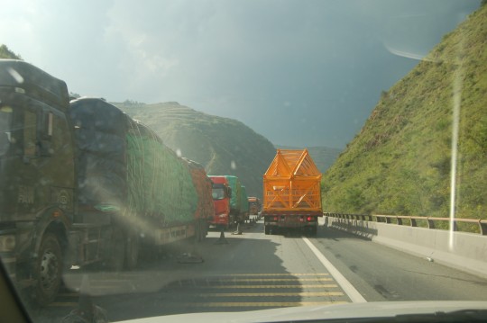
第一天最重要的课程是秦岭地理。车过宝鸡后便沿着渭河河谷穿越秦岭。开始还算顺畅,不时能会跨越一直在公路两翼徘徊的渭河,看见河水混黄,但很快就遭遇堵车——山洪导致塌方,很多路段由四车道变为了两车道,加之车辆大多为重载货车,行驶非常缓慢。
I left Xi’an airport at around 11AM in my rental Chevrolet SUV and headed west on G30. After Baoji, the route follows the Wei River valley, cutting through Qin Mountains . Due to flood damage, the 4-lane highway reduced to a 2-lane parking lot, packed with heavy trucks.
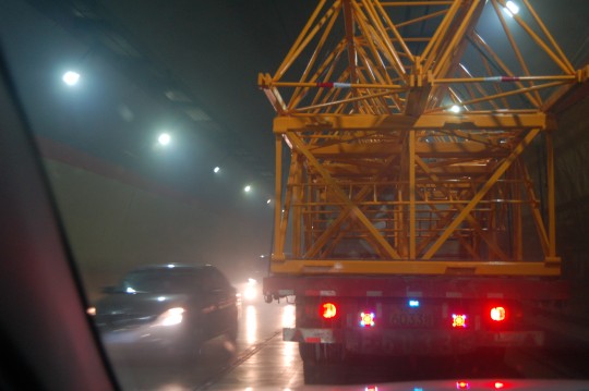
众多的隧道让人想起年初在瑞士阿尔卑斯山的旅行。麦积山隧道这样的双管隧道理应比St. Gotthard Tunnel,、Great St. Bernard Tunnel和Mount Blanc Tunnel要快得多,但因为单向车道运行双向交通,在秦岭山体内的行驶变得非常漫长。
The Qin Mountains boast some of the longest road tunnels in the world ( and #2 is here). They revived my memory of Swiss Alps driving earlier this year. This is Maijishan Tunnel. As a 2-tube tunnel, I supposed to get better experience than St. Gotthard Tunnel, Great St. Bernard Tunnel and Mount Blanc Tunnel, but as one tube was closed, I found myself constantly stopped with 1000 feet of granite above me.
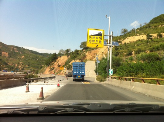
从秦岭西侧下坡时见到的失控车辆自救车道。
Since the majority of the traffic are overloaded freight trucks, many self-rescue lanes like this are available along the west slope of the mountains. It’s a steep-grade branch paved with pebbles.
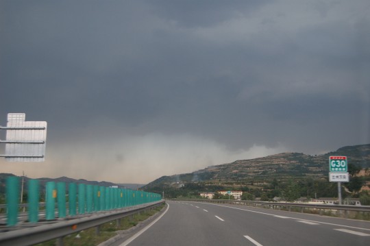
G030连霍高速是整个旅行的干道。第一天全都花在路上。遭遇的除了严重交通堵塞,还有天水附近的一场暴雨。当晚虽未如愿赶到武威,但还是路过了兰州,夜宿永登。原本设想是从兰州出发,但找不到合适的租车商,只好多花一天从西安西行,成了地道的丝路之旅。
My entire first day was consumed by road trip. In fact, most of my time would be spent on G030, an interstate connecting seaport Lianyungang on the east and west border post Khorgas. Besides heavy traffic, I also encountered a storm near Tianshui (literally ‘water from heaven’). This historic city is on the Silk Road, which started at Xi’an. I stayed for the night in Yongdeng, a small town in the suburban Lanzhou, a very important industrial city by the Yellow River. Lanzhou was my planned starting point, but was replaced by Xi’an due to difficulty in finding reliable can rental company. Spending one more day on the road, I coincidentally made my trip resembling a Silk Road journey.
DAY 2:永登-玉门 (Yongdeng – Yumen, 825km)
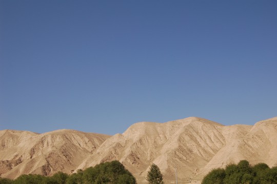
从永登向西北行进,地貌已经显著改变。干旱的影响是最大的——除了公路穿过的河谷地带有一丝绿色外,两侧的山峦已经寸草不生。
Leaving Lanzhou, the landscape changed dramatically by obvious drought. The majority of green lies in the river valley, along the road.
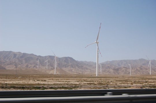
穿过祁连山东端的乌鞘岭后,进入了河西走廊,公路两翼分别是山脉和荒漠。另一显著变化就是风力加强。西北是中国的风之谷,这只是个开始。
After passing Wushao mountain, the eastmost branch of Qilian Mountains, I entered the Hexi Corridor with Qilian on the left and the Gobi Desert on the right. In addition to drought, presence of these artificial giants indicates high wind. The corridor, which the Silk Road passed through, played an significant role in Chinese history.
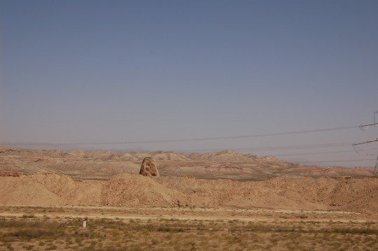
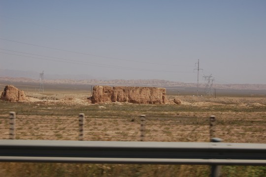
不知过了多久,公路边的另外一些物体吸引了我。一些很小的土塔,一些残垣断壁,有的还被脚手架环绕。我很快就意识到这是长城。1997年,我曾从兰州出发去敦煌,但路过这一地段时已入夜,自然没看到。
It took me a while to notice the man-made structure on the right side of the highway, maybe due to the fact that they resemble walls of old farm houses across all over China. But I suddenly realized this is the Great Wall of China. In 1997, I used to take long-distance bus (Chinese Greyhound) from Lanzhou to Dunhuang. Must be in the dark of the night when I passed by.
长城就这样在沉默中绵延,阻隔了北方大漠和异族,我能遥想它给古代旅人们带来的平安。不久(视频2:20处),公路从一个叫长城口的地点穿过城墙开始爬坡,长城很快就消失在左侧低地的视限外。山丹的长城是明长城,但和山海关的砖石构造不同,是用夯土版筑,这让我感到温暖——小时候见过、住过和涂划过的中国传统民居有很多都是这样的墙。
This section of the Wall in Shandan county, was built during the Ming Dynasty. Another Ming Dynasty Great Wall section in Badaling, almost 2000km to the east, with a brick-and-stone construction and a visitor-friendly location ( 1-hour driving from Beijing) has become the symbol of China. In contrast, the Wall in Shandan was built with rammed earth and located in a remote region in northwest, weathered and desolated. Xiongnu and other notorious nomads from the north were already diminished into history when the Wall was build here, but I can still sense a strange feel of security while driving behind it. And a sense of warmth, even in a hot September day. Maybe because it reminded me of the wall of my Aunt’s house, which I enjoyed poking and scratching as a kid.
Note: in the video, I pass through the Wall at 2:20.
In his book Country Driving: A Journey Through China from Farm to Factory (Harper, New York, 2010), Peter Hessler depicted similar fates of the portions of The Great Wall in rural areas. Worth a read.
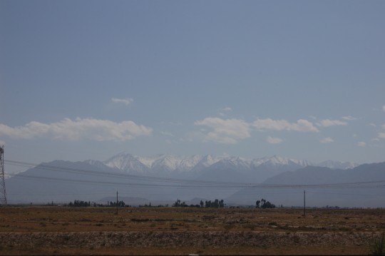
天虽晴朗,但能见度并不高。终于,我在午后望见了祁连山的雪峰。
Despite being a sunny day, the visibility along the Hexi Corridor was not impressive. In the early afternoon, I finally caught a glimpse of the snow-capped peaks of Qilian Mountains on the south.
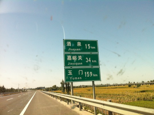
今天路上唯一要停下来的目标是嘉峪关。
The only stop I was going to make this day was Jiayuguan. It’s the first pass on the west end of the Great Wall. Now there is a city named after it. Over many years, when I thought about The Great Wall, Jiayuguan is vivid in my mind. To me,the strategic location it holds between mountains, oasis and desert certainly resonates with my imagination of a border pass of an great empire, while the majestic design of the pass itself followed authentic Chinese aesthetics. One of my favorite spots on Google Map.
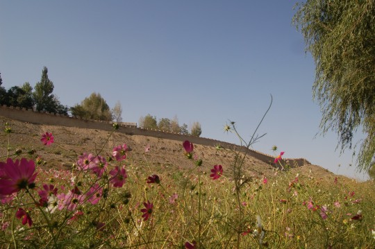
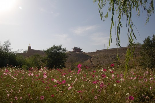
97年来嘉峪关,直奔城里,完全没注意到关城周围有一个“景区”的存在(或许它当时确实不存在)。这次在墙外无人的路上走了一段。
Last time I visited the pass was 16 years ago. At that time I directly marched into the pass. This time I walked around it. These are shots outside of the outer wall. In Hexi Corridor and onward, each outpost was essentially based an oasis.
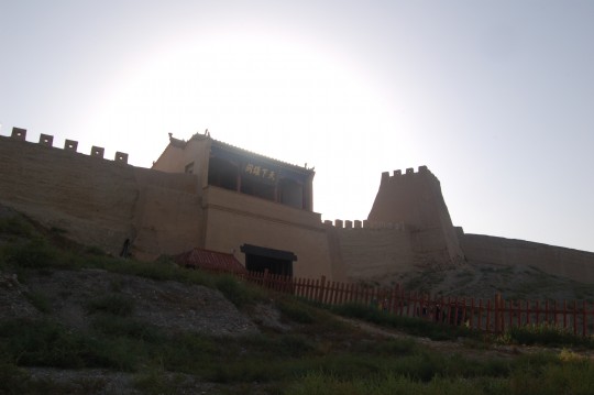
终于,我从侧面接近了关城。
The east gate on the outer wall.
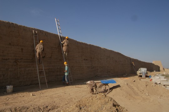
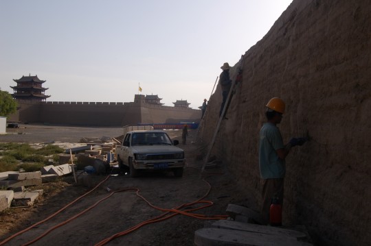
外墙维修。
Repair work in progress for a portion of north outer wall. With only over 600 years of history and being a hot tourist spot, the pass is relatively well preserved. In the background is the inner city.
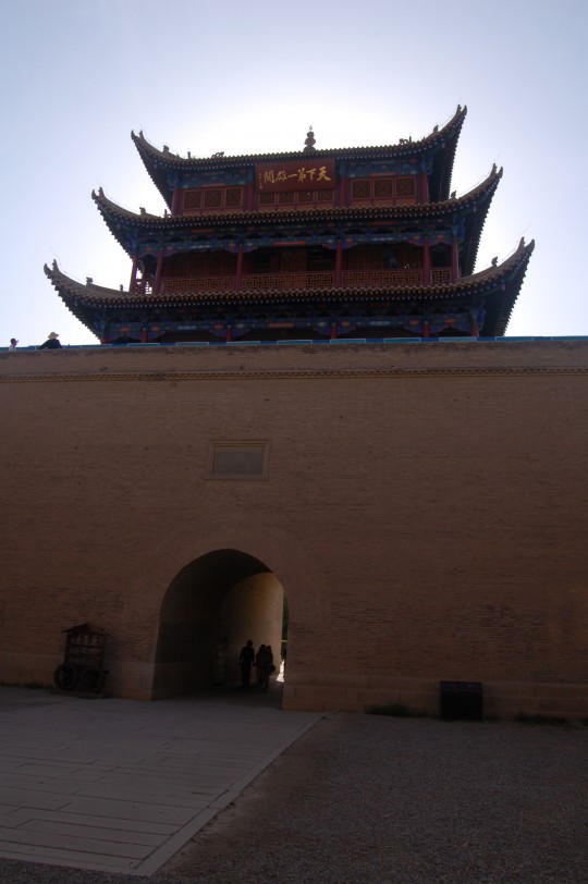
内城东门。
Shot of the east gate of inner city from its wencheng structure. The concept of wengcheng is comparabled with barbican in a western city/fortress, but not exactly the same. The plate on the building reads ‘The First Great Pass Under Heaven’.
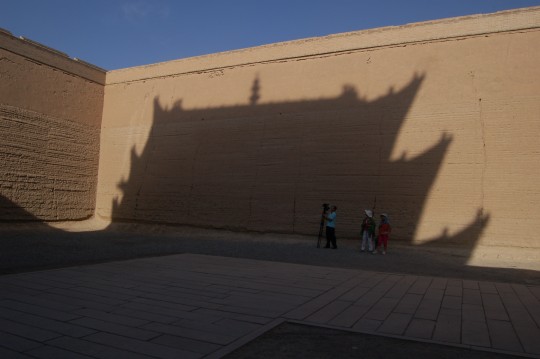
东门瓮城。真希望有个广角镜头。
I stood in the wengcheng structure of the inner city’s east gate. This is an area surrounded by walls for added protection for the gate.
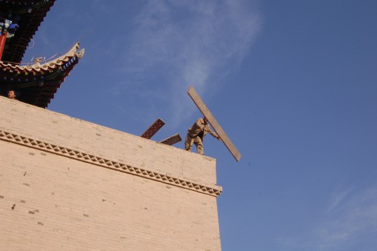
维修工人从东城楼投放脚手架。
Maintenance worker threw scaffolding parts off the east gate tower.
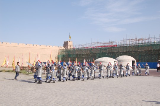
Inside the inner city, a group of ‘soldiers’ in ancient costumes and weapons, ready for a show. Massive maintenance work in progress in the background.
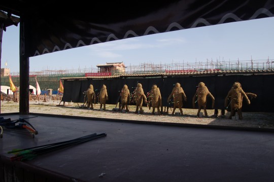
嘉峪关始建于明代,所以这些敌对的生灵肯定不是匈奴了。
Archery Game. Based on the setting, these must be a group of foreign invaders. They do resemble aliens. Or orcs, ‘bred from the heats and slimes of the earth’.
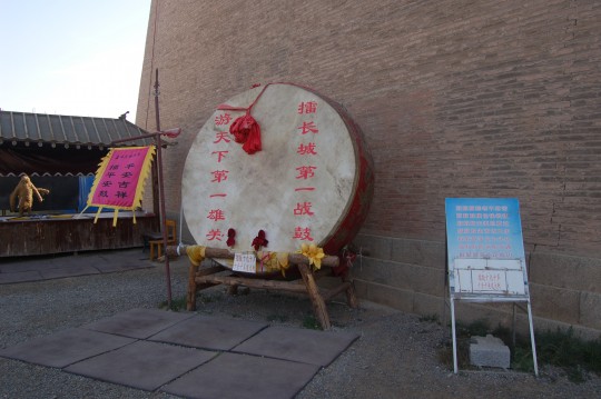
It will cost you about $1.5 to bang this ancient-style military drum. Must be very loud.
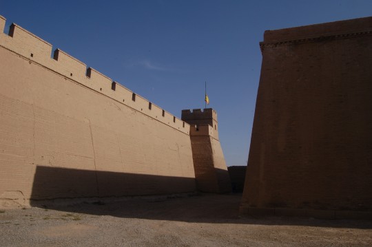
The space between inner wall and outer wall is very limited on the west, north and south sides of the pass. Any enemy reaching this area will be stranded and exposed under attack.
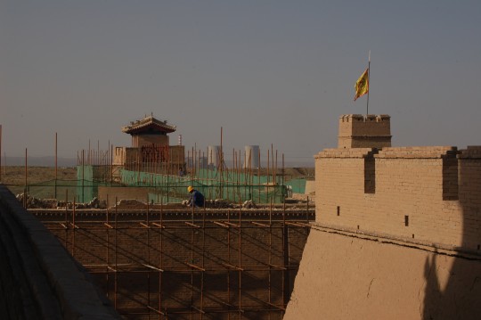
北望。角楼和冷却塔。
The pass is undergoing a massive repair phase. New cooling towers in the background.
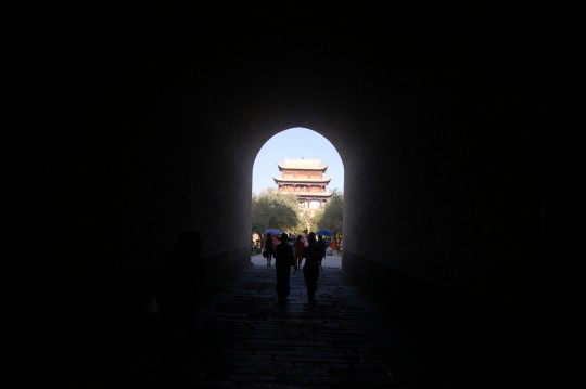
从西门内眺望东门城楼。
Viewing eastward from inside the west gate.
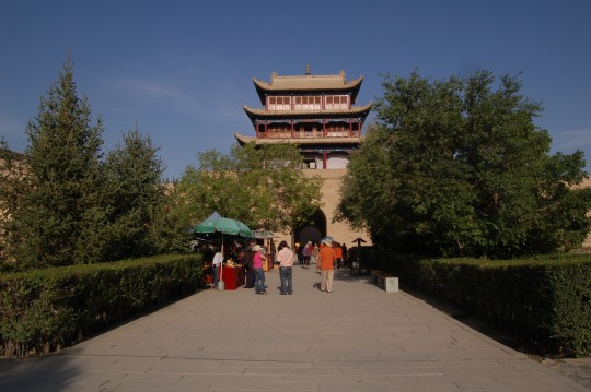
(内城)东门城楼。
East gate of the inner city.
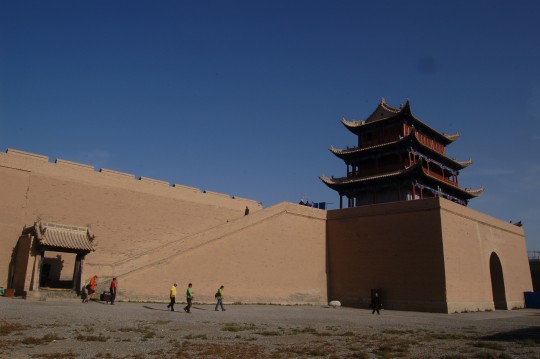
登东门城楼的阶梯。
Steps leading to the east gate tower.
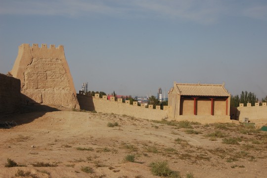
外城东北角楼。墙外是大片的石化工业设施。
Small watch tower on the northeast corner of the outer wall. Large amount of petrochemical facilities in the background.
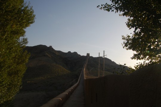
悬壁长城。门票包含在嘉峪关门票中,但我是唯一的游客。
Xuanbi Great Wall, literally ‘ Overhanging Great Wall’, is a portion of Ming Dynasty Great Wall built on a steep ridge (one section has a 45 degree slope). This might explain why I was alone here, even the entrance fee is included in the ticket for Jiayuguan as bonus. The additional travel requirement (8km north from Jiayuguan, no public transportation) might be another factor, although there were full of licensed and unlicensed taxi cabs outside of Jiayuguan entrance.
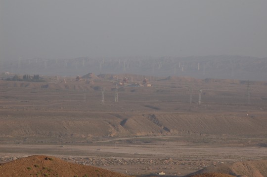
爬这段长城主要是希望远眺雪山背景的嘉峪关。但来路上已经意识到距离太远,200mm长焦也只能看个大概,而背后的远山完全消失在可悲的能见度中。
One major (and naive) purpose of my visit is to view Jiayuguan in distance, with snowy Qilian Mountain as background – I have seen many stunning beautiful pictures with such a setting (e.g., this one). However, just like what I realized on my way here – the distance’s too far, even using 200mm zoom I could only see a very small pass surrounded by transmission towers, and the mountains were not visible at all due to poor air quality.
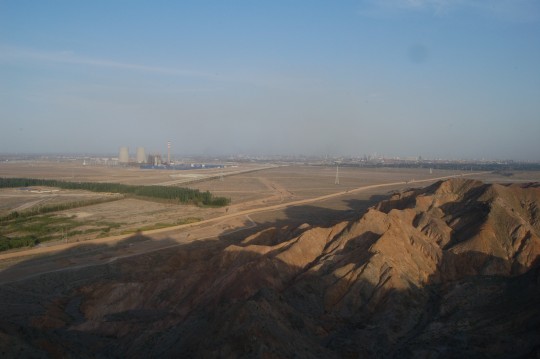
从悬壁长城顶端的烽燧远望嘉峪关市。
These plants must contribute greatly to the smog in the Hexi Corridor. Across the center is the Great Wall connecting Xuanbi Great Wall and Jiayuguan. Yes they are all connected as one great engineering wonder of the world. More impressive than the spaceship launch pad in Jiuquan less than 200 miles from here.
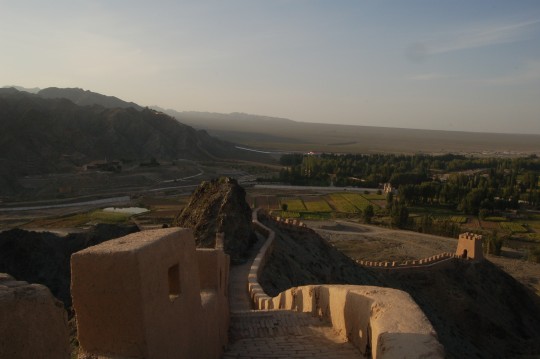
悬壁长城的主要功能是镇守两山间的石关峡。
Xuanbi Great Wall guards the Shiguan Gorge, the area between two mountains. Take a look at Google Map to understand its strategical location. The Wall passes through the Gorge and climb along the ridge on the opposite side.
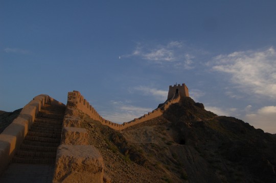
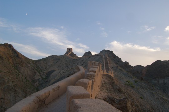
整个上下山过程中见到的游客只是两个女中学生,显然是本地人。
Xuanbi Great Wall was largely rebuilt over its ruin, and again, much less impressive than the massive brick-and-stone Wall near Beijing. However, if you want to get a feel of true spirit of the Great Wall without being pushed around by thousands of tourists, this is a short excursion you could do when visiting Jiayuguan. During my entire ascending and descending, the only human beings I met were two high-school girls, obviously from local. They will surely remember such experience when they grow up and head towards metropolitans in east or south China, like most young people from undeveloped west China do.
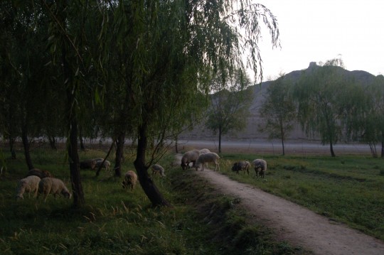
在长城护佑下,羊儿可以安详地吃草。它们的祖先就是这样生活的。
Sheep grazing as the Great Wall lies in the background and the beacon tower I just climb overseeing them. It must have been like this over the past many centuries, when the frontier life relied on the power and determination of the empire.
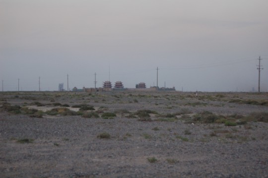
沿另一条公路从嘉峪关西侧驶过,没找到任何开放的岔道可以靠近它,只有绵延的铁丝网。透过网眼望去,眼前的景象令人想起Derek Jarman在核电站旁的小屋和花园。
The last shot of Jiayuguan, taken behind a fence miles long – I attempted to find a road to drive closer but failed. The isolated ancient architecture with modern petrochemical structures in the background, the sandy land with a few desert plants, strangely remind me of Derek Jarman’s house and garden in Kent with Nuclear Plant in the background.
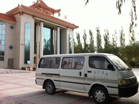
当晚又往西赶了一百多公里,夜宿玉门市。市区离高速有一段黑灯瞎火的小路。因证件不全被酒店拒绝,最后好不容易被本市唯一一家“涉外”酒店收下,随即又被要求和酒店经理一起前往派出所登记。
This night I spent at Yumen, the first oil town in China. A few miles of dark road off highway before reaching lighted streets. The city is small, but like many Chinese cities, has a street dedicating to dining through late night. After being refused by a hotel for lacking of proper IDs, I decided to go to the only hotel in town catering to overseas guests (yes there is an official category of hotel for this China, enforced by authority). However, just after dropped my shoes in my room, I was called and asked to go to the local police station to get ‘registered’. The journey was companion-ed by the hotel manager, at 10PM.
Everything about this hotel is in traditional style, including its front facade and this 80s Toyota caravan – such vehicles were usually purchased for accommodating officials or foreign guests.
DAY3: 玉门-玉门关-汉长城-河仓故城-敦煌 (Yumen – Yumen Pass – The Great Wall of the Han Dynasty – Hecang Ruins – Dunhuang, 454km )
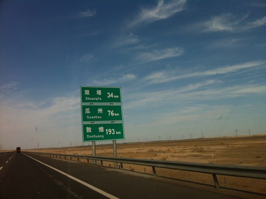
从玉门向敦煌行驶,在瓜州附近离开G030。路上会经过双塔,据考证是唐代玉门关的所在,也是玄奘在胡人徒弟石盘陀(孙悟空原型)帮助下偷渡出关的地方。不幸的是,它已被双塔水库淹没(详情及类似悲剧故事推荐阅读朱幼棣《后望书》)。
Traveled west towards Yumen Pass ( The Pass of Jade Gate) built in the Han Dynasty. On the way, I passed Shuangta (“Double Towers”), which was believed to be the location of Yumen Pass during the Tang Dynasty – Yes, the pass did move along with route changes due to extension of military protection, abandonment of outposts, etc. The possible site of the Tang Yumen Pass was submerged in a reservoir as one of the victims of many dumb development projects over China in the Mao era.
The Tang Yumen Pass was also the spot where Xuanzang sneaked out of the pass with the help from his local disciple Shipantuo despite of travel ban. Xuanzang, likely the most famous and respected monk in Chinese history, embarked a journey on foot from Xi’an all the way to India in 629 for Buddhism study and brought back many precious Buddhist text to Xi’an in 643. One of the greatest Chinese literature works, The Journey to the West, was based on his deeds. But the story was heavily dramatized by adding fictitious roles such as the Monkey King, a powerful yet beloved character known worldwide, whom was believed to be modeled after Shipantuo.
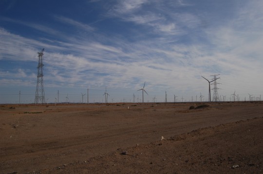
瓜州风力发电的规模在全球应该是名列前茅的。
Windmills established north of the highway, extending for many miles. Guazhou boasts one of the largest windmills in the world.
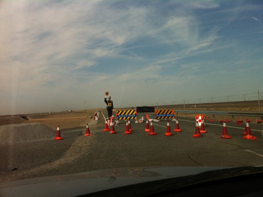
From time to time, I still saw the road closure, and greeted by this fake traffic police.
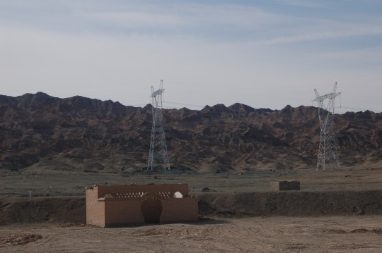
从瓜州至敦煌的S314,路东南是三危山。
I exited G030 at Guazhou and headed towards Dunhuang on S314. Left of the road is Sanwei Mountain. On the west end of this mountain is Mingsha Mountain(‘the Echoing-Sand Mountain’), a huge dune where the world-famous Mogao Caves (Caves of the Thousand Buddhas) was built on. Based on multiple historic documents, in the Han Dynasty, a Monk called Le Zun witnessed a thousand Buddhas glowing on top of the Sanwei Mountain, and started building the caves on the spot where he stood.
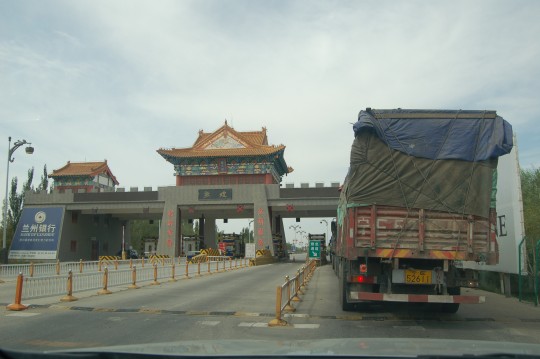
Toll gate outside of Dunhuang, which was established on an oasis(Google Map).
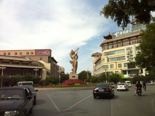
The sculpture at city center, depicting a dancer playing pipa on her back, was based on the paintings in the Mogao Caves.
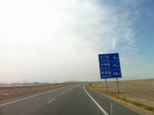
出敦煌,驶向通往玉门关的岔道。左侧是鸣沙山。
Headed toward the intersection to Yumen Pass ( Han Dynasty). Mingsha Mountain, the great dune where the Mogao Caves are located, is on my left. I skipped this internationally acclaimed tourist destination not just to save some time, but also because art appreciation was not part of my plan for this journey (and I’ve visited it in ’97). The caves were heavily damaged early last century ( among the negligence and travesties included some reckless Harvard professor peeled off many murals using adhesive tapes) , but significant efforts have been made to preserve and document the site.
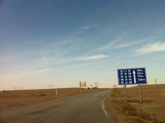
从S314换上通往玉门关、汉长城和魔鬼城的道路。这条路貌似是近些年才铺设的。本来魔鬼城在我名单上,但确认私家车禁止入内只能乘坐游览车走马观花之后我果断放弃了它。别处有可以自由通行的的雅丹。
I soon exited S314 and proceeded towards Yumen Pass(58km), The Great Wall of the Han Dynasty(62km), Hecang Ruins(70km) and Yadan National Geological Park (128km). The last spot is supposed to offer great scenery of yadang landform, and was also a part of the Silk Road, however I promptly dropped it from the list after confirming that no private vehicle is allowed in the park and all tourists have to pay for the park’s tour-bus for very limited views. I would find more legendary yadang elsewhere, free of charge and restriction.
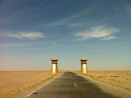
在荒原中行驶五十多公里。
These ancient-style posts are the only man-made objects over the barren land over the next 50km.
抵达玉门关的最后旅程
Approaching Yumen Pass
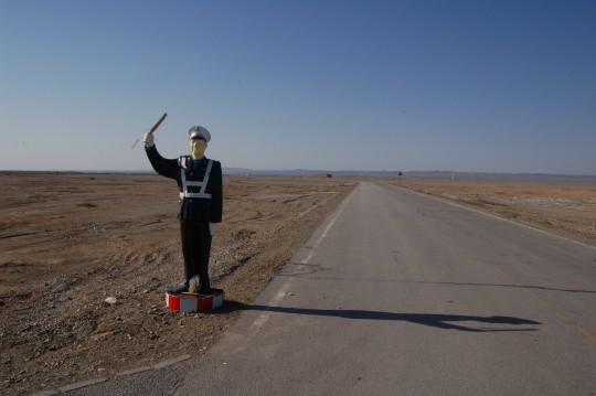
通往玉门关的最后一个路口。该塑料警察的左侧是通向汉长城和魔鬼城的公路。
Through a ticket gate and a few miles further north, I came across another traffic police, whom I have met many times on the way from Xi’an. This time he’s like an immigration officer, as Yumen Pass, the flat building on the horizon, operated as the primary immigration post on the northwest border during Han Dynasty, where the officials of the great Han Empire inspected foreign traders and missionaries before putting seals on their documents. Loads of jade excavated from mountains in the west were imported, and rolls of silk from China were exported, all the way to Rome.
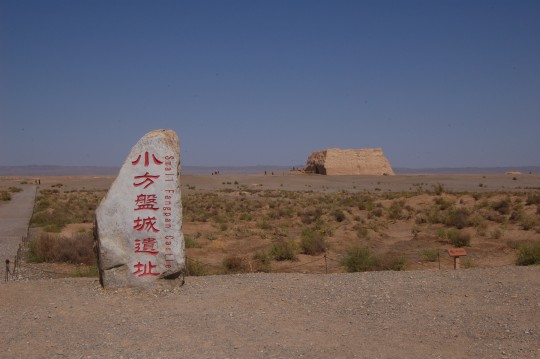
看来当地人更喜欢使用的“小方盘城”是玉门关的官方名称。在斯坦因的地图和记录中,它是T.XIV。
Yumen Pass has another official name: Small Fangpan Castle (Fanpan literally means ‘square stack’), which local people prefer to use. Yumen Pass was more frequently used in Chinese historic documents and classic poems. Certainly, Yumen (Jade Gate) reveals its nature of business, also sounds more poetic. (Google Map)
English scholar Aurel Stein did comprehensive study on the Han Great Wall system in the region, which was much less known than his extremely controversial acquisition of many ancient scripts in Mogao Caves. Yumen Pass, referred as T. XIV in his records, looked like a command center to him due to its size and a wall thickness of 15 ft.
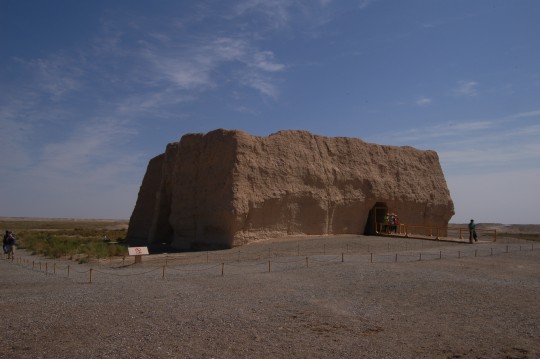
北门和西门。
The pass has two gates, facing north and west.
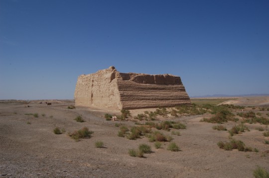
东墙和南墙。玉门关门票包含在魔鬼城门票中,所以游客们都会来这儿转一圈,但大多是匆匆拍完照就走。路过不止一个全身越野打扮的人,挂着比我的相机昂贵十倍的设备,嘴里嘟囔,“跑那么老远就是来看这么个大土堆?”
Again, the entire building was constructed using rammed earth. It is surprisingly well preserved despite an age over 2100 years.
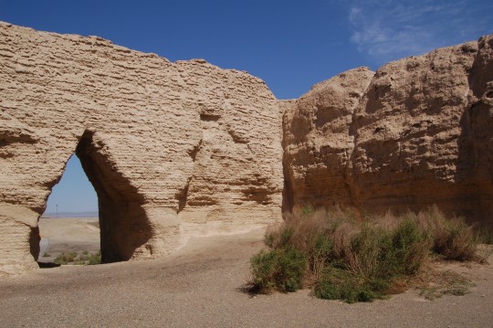
牧羊人曾在此寄留羊群。北门外是当年的丝绸古道。
The pass has no roof remaining, and there is nothing inside. Shepherds used to keep their herds of sheep inside. In the view from the north gate lies the ancient Silk Road.
从玉门关驶向汉长城,凝视当谷燧。您也会目睹万恶的银色内饰如何毁掉我的拍摄。
From Yumen Pass to the Great Wall, with Danggu Beacon Tower in the center of the last view. In this video (and next few) you will see how the nonsense silver dashboard decoration of my Chevrolet cast a disastrous impact to my fiming.
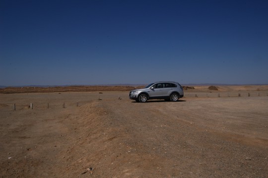
Drove another 10 minutes, I parked in front of a portion of the Great Wall of the Han Dynasty.
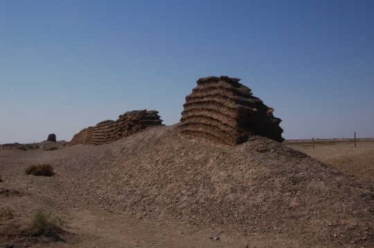
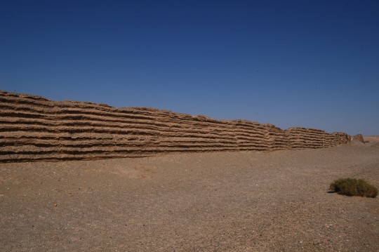
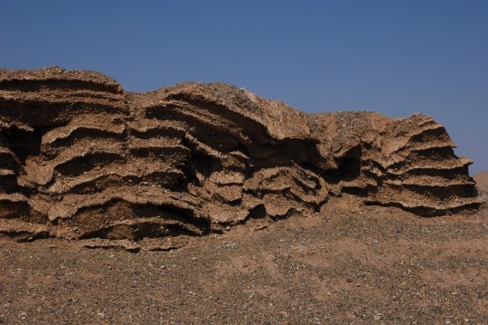
这段是现存最完整的汉长城,残高大约三米。注意就地取材添加芦苇灌木层的建筑方法,帮助这段伟大的城墙经历两千多年不倒。斯坦因在1907年考察时,发现沿着墙内有古代士兵巡行反复踩踏留下的小道。1914年他再度到来时发现了上一次自己坐骑留下的蹄印。在80年中日合拍的纪录片《丝绸之路》中,由中国军方护送(并监视)的探险队出发前往罗布泊,吉普车应该压过了那条小道。在此地成为旅游景点之后,小道应该已经无从寻觅了。
10,000km of the Great Wall was constructed during the Han Dynasty, and this section is best preserved, with a current height of 3m. Some sections revealed the slow-motion wrestle between harsh environment and human intelligence. Due to lack of construction material, branches of local shrubs were embedded into the wall for reinforcement. A wall built with earth still stands after 2100 years in such a windy desert. A miracle. In the top picture, Danggu Beacon Tower, can be seen in the distance.
When Stein surveyed here in 1907, he found an ancient path along the wall, which he believed was formed by footsteps of patrolling soldiers. When he came back in 1914, he identified the hoof prints his horse left 7 years ago. Many more people walked this path after the wall became a tourist spot. In the classical documentary TV series produced by NHK/CCTV in 1980, the expedition jeeps directly drove on the path when they headed to Lop Nor, following the ancient Silk Road.
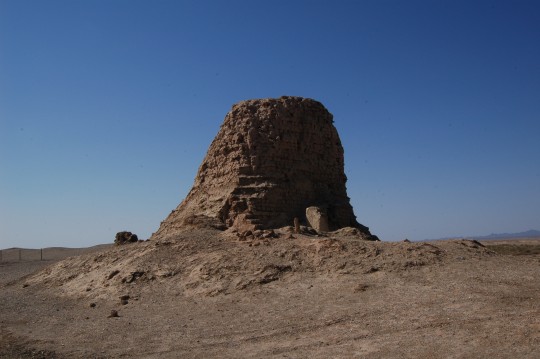
当谷燧,斯坦因掘出大量汉简的地方。通往燧顶的台阶还有遗存。
Danggu Beacon Tower (Google Map). Aurel Stein excavated large amount of Han bamboo slips under the tower (which he referred as T. XIII). A portion of step cases leading to the top still remains. One layer of weeds was used for every 3 layers of mud bricks.
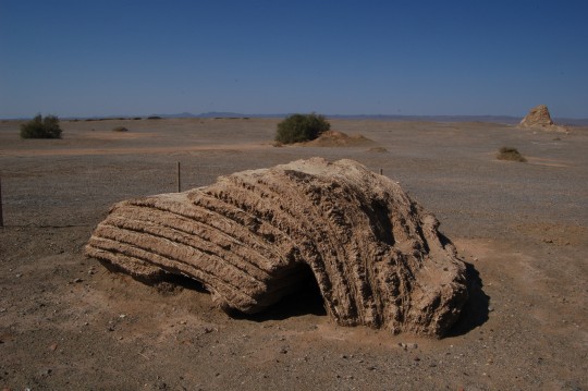
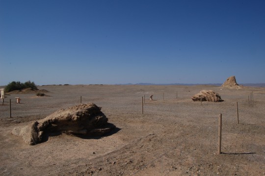
经历两千年已经石化了的积薪。最右侧是当谷燧。附近出土的汉简制定了根据敌人数量、距离和时辰燃放积薪的规则。
Firewood heaps were stored beside the beacon towers of the Han Dynasty. With Danggu Beacon Tower on the right. Sat in dry weather for over 2000 years, these heaps were already fossilized. According to the bamboo slips excavated nearby, there was literal rules on signaling, depending on size and distance of enemy troop, whether it’s daytime or night, etc. I must emphasize the Great Wall was not just a defensive barrier, it was also a highly effective military signaling system. In The Lord of the Rings, there were almost 2 minutes of amazing shots on how beacon fire signal transferring across mountains in lightning speed.
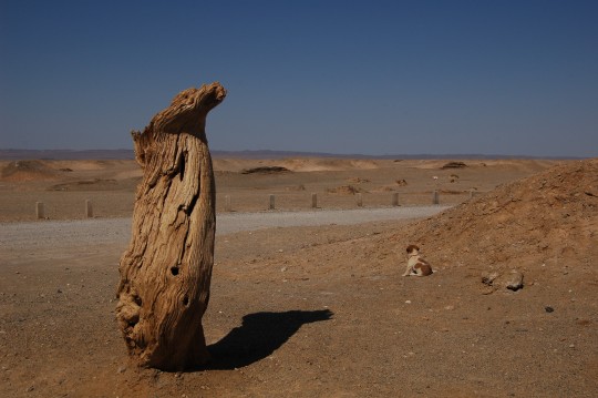
在胡杨的陪伴下,一只小狗注视着汉长城和城外匈奴的影子。
A doggy stared at ancient wall, imagining Xiongnu on their horses outside the wall. On her left is desert poplar, one of very few species grown in the deserts of central Asia.
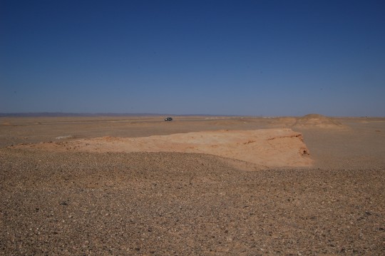
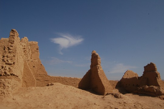
开车沿一条旧路向西行驶,企图看见更多烽燧,但后来发现旧路和新路都转向长城外了,继续寻找烽燧使用需要更好的车辆去走崎岖的石子路。
I drove further into the depth of desert and took a walk from my car.
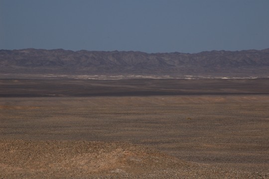
Also took some pictures of an unusual landmark previously reported in some U.S. news media (Google Map).
路过玉门关驶向河仓城。
On the road passing Yumen Pass to Hecang Ruins
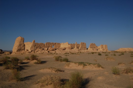
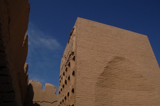
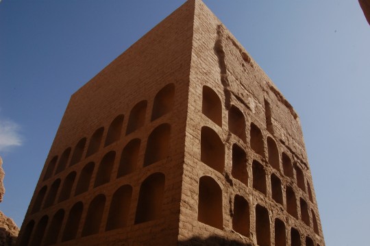
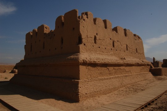
河仓城也叫大方盘城。斯坦因当年根据地基高度以及墙上无窗却有巨大开口等情况判断这(T.XVII)是一幢大仓库,后来经考古确认为汉代的军需仓库。
Ruins of Hecang Fortress (Google Map) , aka Big Fangpan Castle, 132mx17m in size and a remained wall height of 6.7m. When Stein arrived the site (T. XVIII) by following the Great Wall, he thought this large building, out of nowhere 10km east of Yumenguan, could be some kind of storage, as the building was built on an elevated base, and walls have large openings on them. Later discovery of documents onsite proved it.
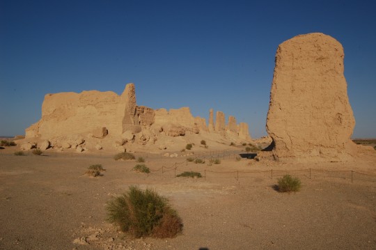
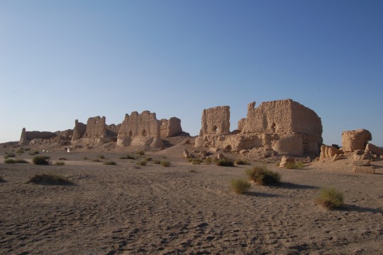
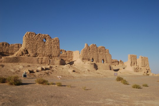
墙上的开口帮助仓库通风,而高地基能够减少鼠害。
The openings on the walls were for air flow purpose. Elevated helped maintaining a dry and rodent-free condition.
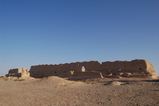
北墙。
The side facing north (outside direction of the Great Wall).
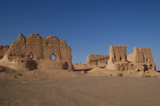
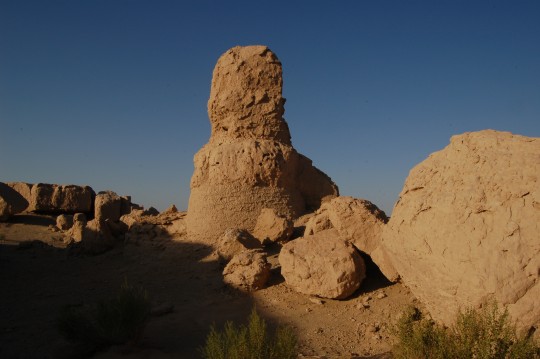
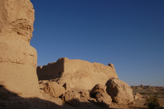
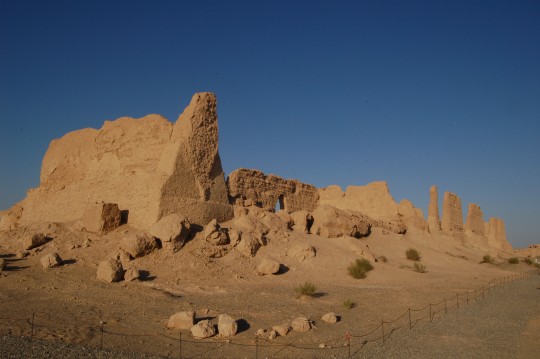
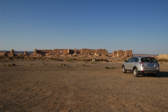
和这片庞大的废墟独处,看着残垣的影子拉长。整次旅行中最感人的时刻之一。
Again, I was all alone with this fortress in the late afternoon, watching it shadow stretching over time.
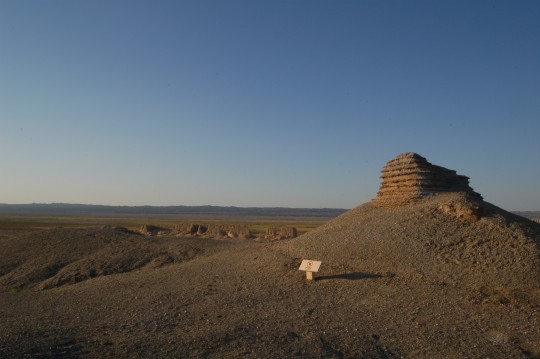
仓亭燧。从这里可以看见河仓古城所处的隐蔽低洼地势。利用北侧疏勒河的沼泽遮挡,古人省去了建长城的劳力。
Cangting Beacon Tower(Google Map), an over-watching beacon tower 100m south of the fortress. As seen in Google Map, the fortress was strategically situated in a low lying area behind a large swamp created by Shule River, therefore, no wall was needed and guarding the fortress was relatively easy.
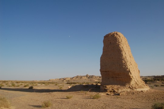
从苍亭燧南望,地平线尽头的山丘上坐落着另一座烽燧。
Another side of Cangting, top of the hill on the horizon is another beacon tower.
在夕阳中,从河仓城驶向玉门关
From Hecang Ruins to Yumen Pass before sunset
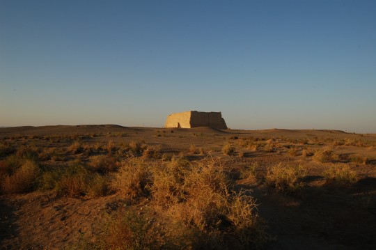
回到玉门关等日落。
I returned to Yumen Pass. I’d like to stay with it until sunset.
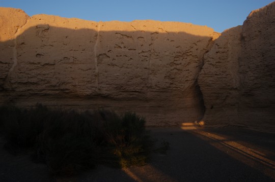
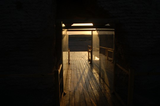
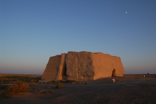
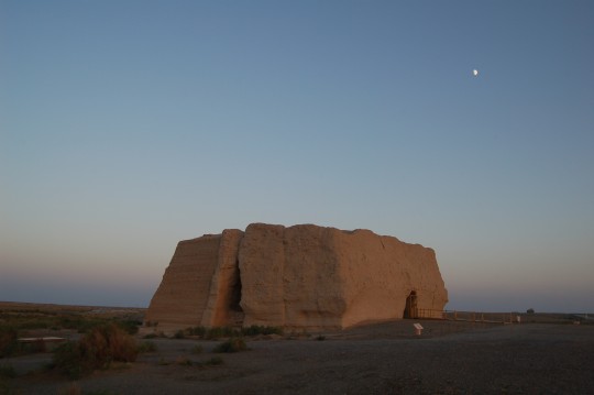
月亮与边关。这时我想到的是南方的亲人们和位于麻省Woburn宠物旅馆中的猫美。
The moon and an ancient pass synthesized a perfect mood for Chinese poems about frontier and homesickness. I wonder whether this is a classical sentimentality inherited in all Chinese. But I was far away from my family members in Yunnan, my home in Cambridge, and my cat in Pets Hotel in Woburn, MA. At the moment, she just did morning stretch, meowing for room service,and of course, missing her grandpa.
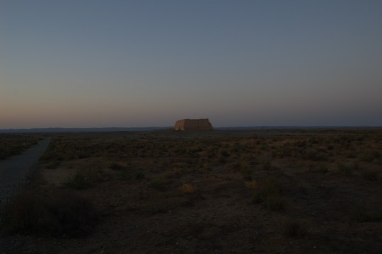
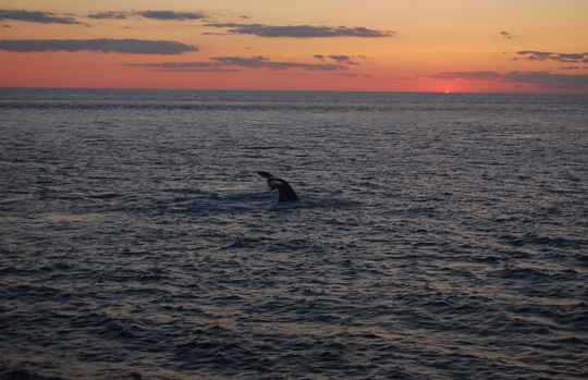
这幅照片让我想起八月生日时独自在大西洋上拍摄的另一张照片。都是巨大的古代生物安详等待黑暗到来。
Yumen Pass was abandoned in 5th Century after the new route of Silk Road was established on the north and only appeared in poems as symbol of afar. This scene reminds me of a picture I took in August in Atlantic 2 hour east of Boston. Both are gigantic ancient creatures peacefully greeting the darkness to come.
DAY4 : 敦煌-吐鲁番 (Dunhuang – Turpan, 802km)
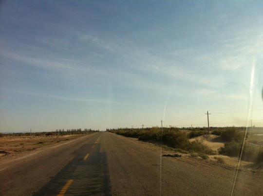
从敦煌向新疆进发可以抄近道G215回到G030上。出敦煌后还可以在路左看到一些长城遗存,并在某处穿过它。然后村庄就绝迹了,我回到了沙漠。
On this day, I took G215 towards G030. A shortcut but still took me about 2 hour. In the first half an hour, The Great Wall can be seen on the left ( northwest) of the road, and there were a few oasis villages. At some point, the road crosses the Wall. No more village, only desert.
在柳园回到了G030。
I was able to merge onto G030 in Liuyuan. Just like other towns on the historic route, the name of this town, ‘ the garden of red willows’, was inherited from its origin as an ancient post station.
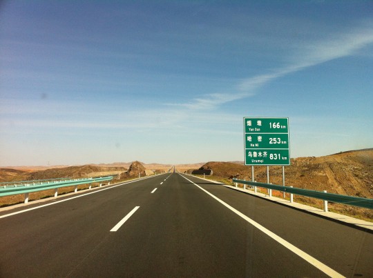
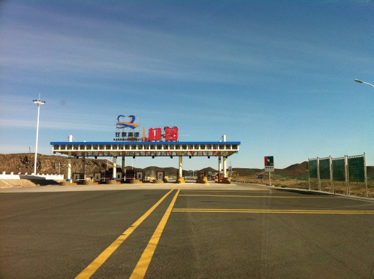
几十里外的前方是甘新交界的星星峡。进入新疆,几乎每个收费站都有携带自动步枪的执法人员查车。
This section of G030 is fairly straight. Soon I would climb over a pass called Xingxingxia, entering Xinjiang Uyghur Autonomous Region , the largest provincial-level region in China offering gems, melons and great ethnic tension. Once in Xinjiang, I found almost every toll gate has a security checkpoint and law enforcement personnel armed with Chinese edition AK-47s. After all I was entering the Mideast of China.
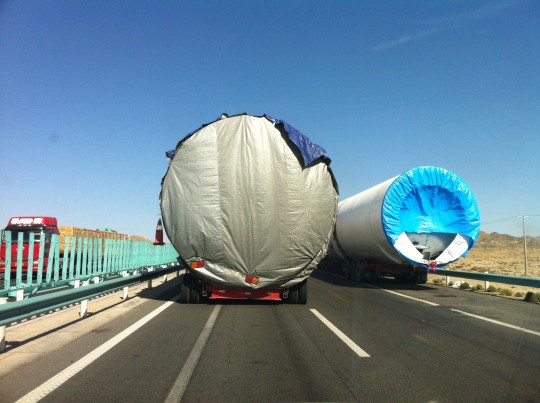
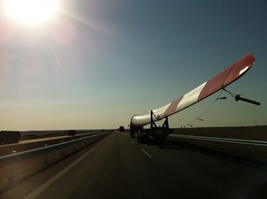
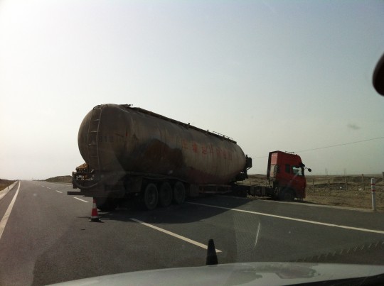
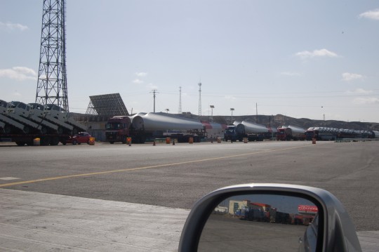
The travelers on this route are usually tractor-trailers loaded with over-sized industrial parts. Private passenger cars are very rare. Guess more tourists prefer taking flights instead of driving cross hundreds miles of no man’s land and paying jaw-dropping amounts of road toll.
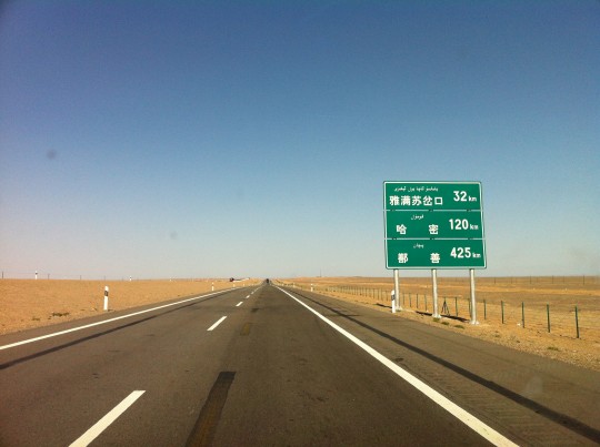
进入新疆,路牌上的拼音被维文取代了。哈密东南的地区是古书中的莫贺延碛沙漠。玄奘在此不小心打翻了水袋,以高僧的意志在几日无水的情况下继续前行,终于在老马带领下找到水源,抵达哈密。 在唐玉门关和莫贺延碛之间有五烽(即今天的白墩子,红柳园, 大泉,马莲井,星星峡),玄奘偷偷循它们前行,但最终,还是被边防军发现,放箭威胁,好在长官敬重高僧,提供了方便——这些在《西游记》中是没有的。
Note that the alphabetic names on the road sign has been changed to names in Uyghur.
When getting close to Hami (120 km away), we are entering an area called Moheyanqi Desert, where Xuanzang traveled alone and poured his water bag by accident. The endured Master, however, trekked a few days without any water and eventually reached Hami. Xuanzang came to Hami from the Tang Yumenguan where I passed yesterday, following five beacon towers established on water sources between Yumen Pass and Moheyanqi(G030 passes all these tower sites). He wanted to be close to them so that he wouldn’t lose his way, meanwhile kept himself out of sights from the military personnel since he sneaked out of country illegally. At one time he was discovered by soldiers and threaten by arrows, but local commander showed great respect and released him, offering water and showing best path.
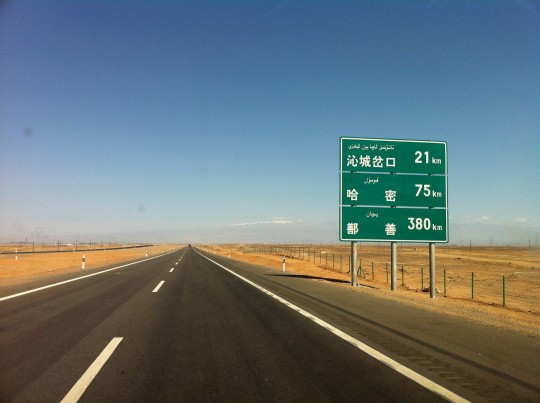
在离哈密75公里的路上,天山最东的余支已经浮现。据明《咸宾录》记载,“……一名雪山,虏过此者皆下马拜”。 哈密可以说是西域交通史最重要的一个名字,汉朝和匈奴曾经多次为此镇展开拉锯式争夺。确实,过瓜州和柳园之后,要跋涉过星星峡和漫漫沙碛才能到达这个孤独的城镇,而下一个绿洲鄯善还要走一千里并翻越红山口。哈密直接导致了丝绸之路北新道的建立,过楼兰的中道和过塔克拉玛干沙漠的南道就随之废弃了,玉门关自然也就迁了址。
据《大慈恩寺三藏法师传》记载,当玄奘到达伊吾(哈密)时,寺院里的老和尚因为能重见乡人,“衣不及带,跣足出迎,抱法师哭,哀号哽咽不能已已”, “法师亦对之伤泣”。 《西游记》中读不到这样伤感的场面。
When Hami is only 75km away, the snow-capped mountain, the east-most branch of Tian Moutains, the largest mountains in Central Asia, becomes visible. According to Xian Bin Lu, a travel document in Ming Dynasty, ancient nomads always bowed to the mountain when it was in sight.
Due to its strategic location as a outpost between long journeys without any supply , Hami was a definitive name for the entire northwest region in history of China. There was quite a tug of war between Han Dynasty and Xiongnu for this town 2000 years ago. And it established a new route for the Silk Road, making the route crossing Yumen Pass (the one I visited) obsoleted.
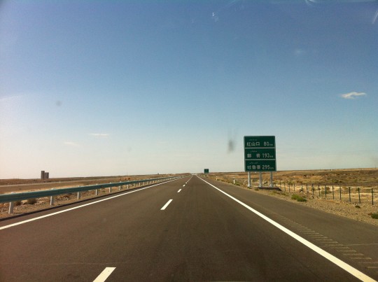
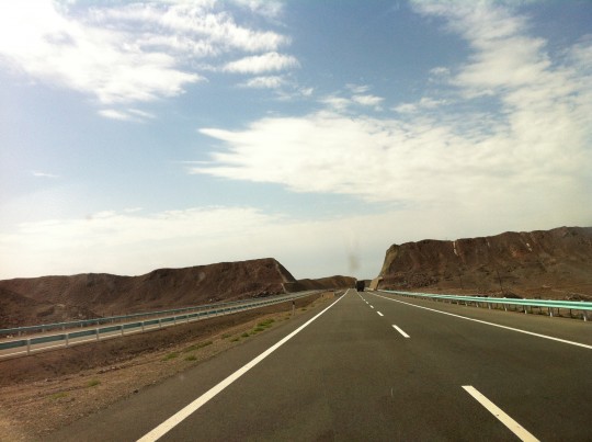
过哈密,翻越红山口。
After passed Hami, we came across another mountain pass called Hongshankou (Red Mountain Pass).
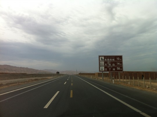
过了红山口是进入吐鲁番盆地的漫长下坡路。左侧和前方是火焰山,我会从胜金口穿越它。
After the pass, the highway descends into Turpan Depression, the 3rd lowest spot on the surface of the Earth, also the driest and hottest place in China. 14km ahead, on the left and front in the picture, are the Flaming Mountains.
G030过吐鲁番市区的区段不是高速,我在一片混乱的交通中蹭了很久,在一个收费站前U-turn才转上去交河古城的路。小孩子乱跑的小街令人感到亲切。
No highway access through Turpan and the local traffic was chaotic. It took me quite a while, including a U-turn before a toll gate, before I was on the final 8km route to Jiaohe Ruins and started this video. The part of Turpan suburban I filmed just resembles any small Chinese town, especially when kids running wild across small streets(2:17). And it’s indeed a very green ancient oasis town spawning vivid life even in a rare gloomy afternoon.
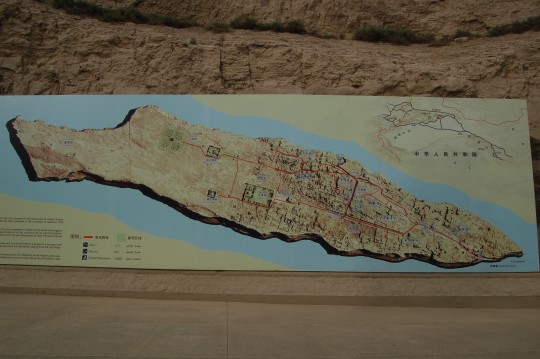
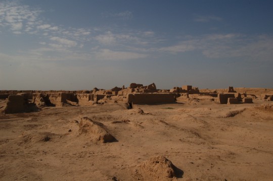
交河城是古代车师国的都城,十四世纪被废弃。陈诚《西域番国志》记载,“崖儿城在土尔番城之西二十里,二水交流,断崖居中,因崖为城,故曰崖儿。广不二里,居民百家,旧多寺宇,有石刻存,古为车师国王所居,后复立交河县治,今并入土尔番焉。” 也就是说,在明代永乐年间,城里还有人居住。
The giant wall map of Jiaohe Ruins. Located on the top of an islet, it is more like a fortress than a city. It was the capital of the ancient Jushi Kingdom between Han Dynasty to the demise of the Kingdom at 5th century. The city was abandoned in 14th century due to warfare damage.
The name ‘Jiaohe’ literally means ‘two crossing rivers’, referring to two rivers surrounding the islet. The red lines on the map are the major routes in the city. A few major square blocks are Buddhism temples and pagodas. Most buildings are on the east-southeast side, with the major entrance near southeast tip. The area in the west-northwest is largely flattened, contains many tombs. (Google Map)
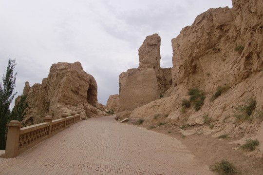
南门。
The main entrance at south gate.
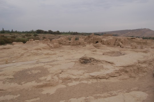
在离南门不远的城内东望。
View northeast shortly after entering the city.
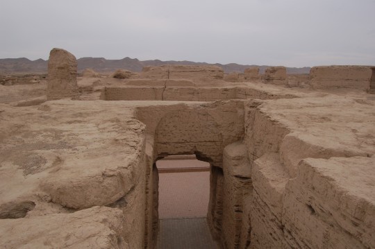
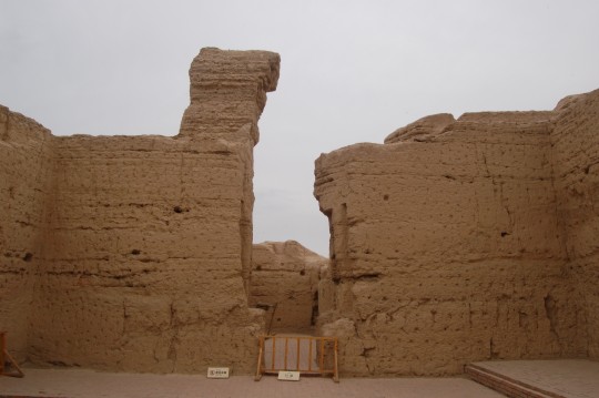
交河最大的特点之一是城内的大量建筑都是用“减地法”(或称“压地起凸法”)从地表下挖构筑的。这是当时的官府建筑之一。
The vast majority of structures in the city were not built over ground, but carved out from the top layer of earth (so called ‘ground reducing’ construction method). Reasonably, some underground structures, such as this one, is better preserved. The area near the south gate is the government office district.
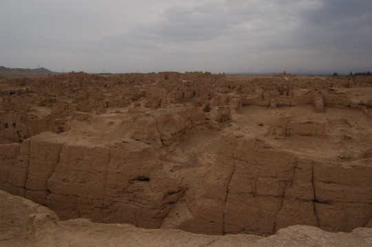
西/西南向的景色。塔林在地平线上的右方。
View west/southwest. Massive building structures, with the pagoda forest on the horizon on the right. According to Chen Cheng, a Ming Dynasty missionary, in the early 1400s, hundreds of households still lived in the city.
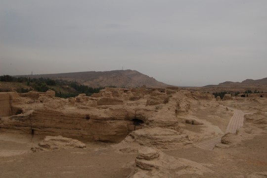
西望,背景是火焰山。
View west, with the Flaming Mountains in the background. The weather was very gloomy during my visit.
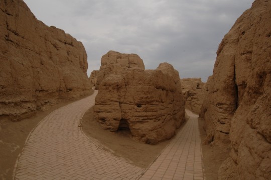
靠近东门的复杂通道和高墙,显然是出于防卫考虑的设计。
Additional high walls and curved routes near the east gate provide additional defense.
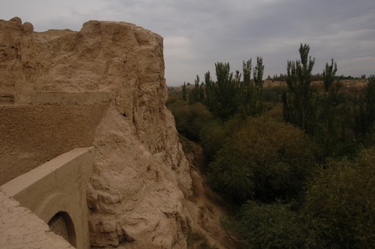
从东门上望向西北。峭壁提供了天然保障。
Northwest view from the east gate. The cliff forms a natural protection.
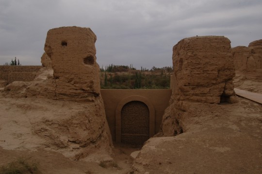
东门。
East gate.
东门内的多重护墙。
The walls facing east gate provide additional defense.
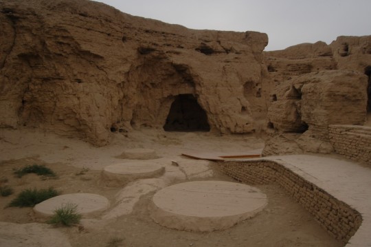
东门内的水井。
The wells inside the east gate.
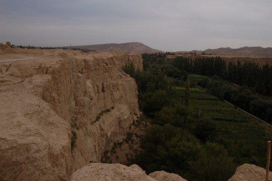
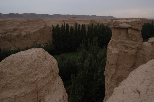
台地西南侧。下方的河床平均深度为30米,宽度为30-100m。所以交河城基本不需要城墙。
The southwest rim of the islet. The river bed has an width of 30-100m, an average depth is 30m. Therefore, no wall is needed for the ancient city except for the area of the south gate.
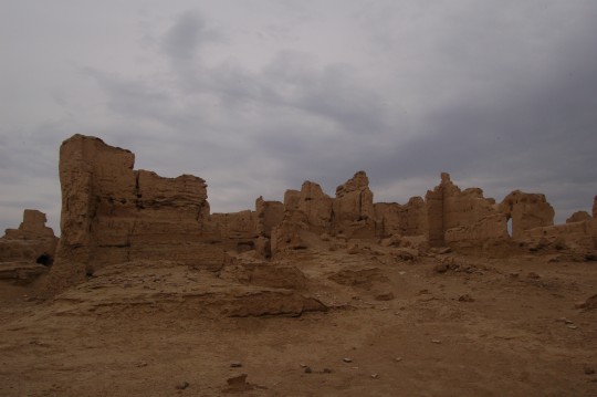
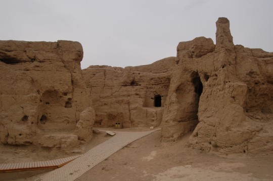
东北部建筑群。
Relics of building blocks close to northeast rim. This is the residential district.
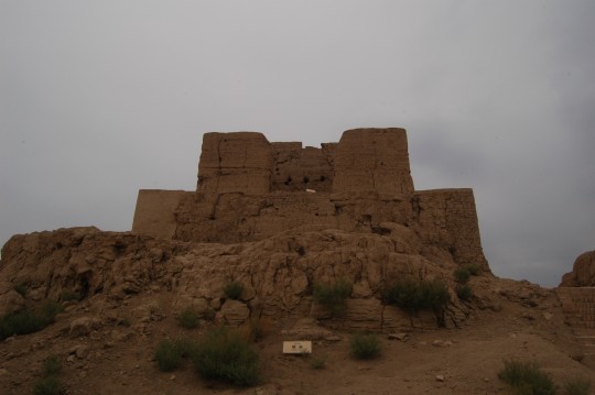
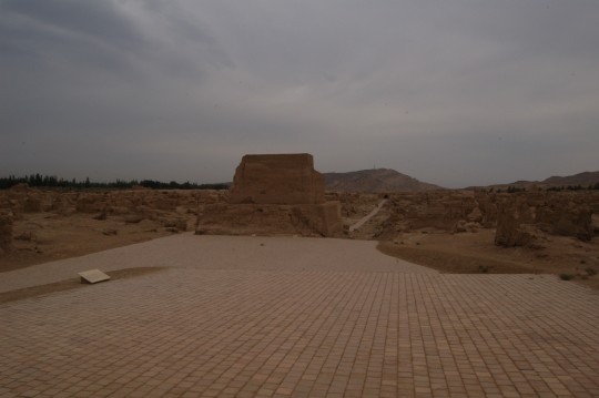
中央大塔。塔前向南门延伸的中央大道穿过官府区,塔后是寺院区。
Front and back of the Grand Central Pagoda, which sits on the end of the Central Road extending to the southeast. It marks the area of Temple District.
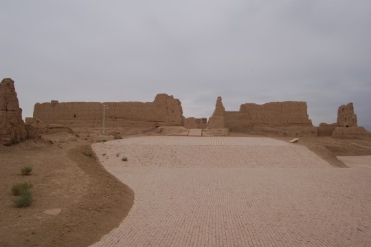
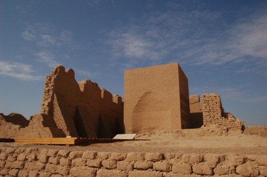
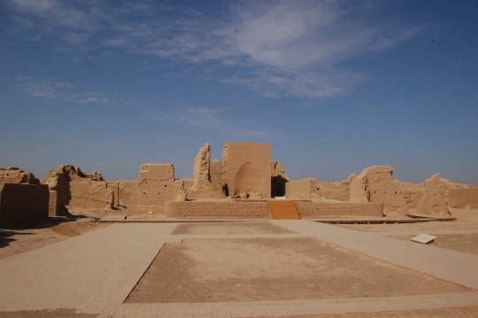
大佛寺。这类大型建筑拥有从地表夯筑的“真”墙。
The Grand Buddhist Temple. Unlike most buildings in the city, the temple, just a like a few other large structures, has ‘real’ walls constructed over ground.
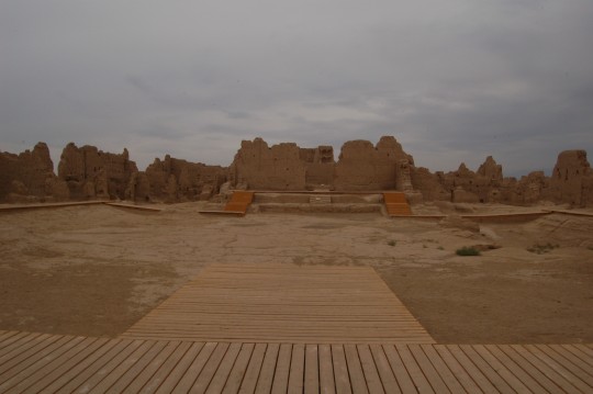
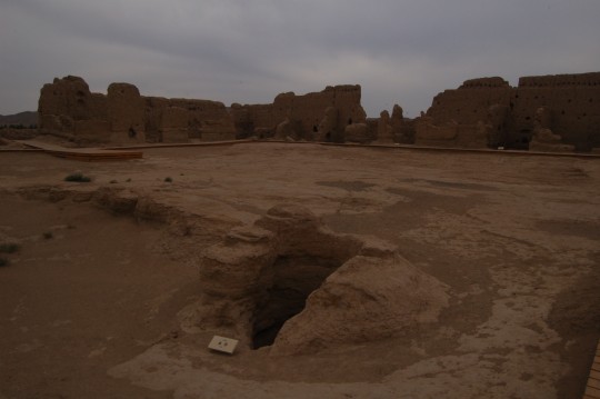
大佛寺内的水井。交河城内这类水井数量巨大,平均深度为30米。
Well inside the temple. Many wells exist in the city, with an average depth of 30m.
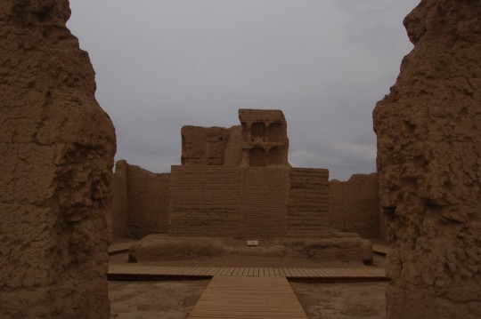
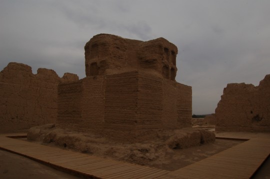
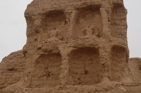
佛塔。塔上佛龛内还遗有残缺的佛像。
Stupa. Relics of statues still remain.
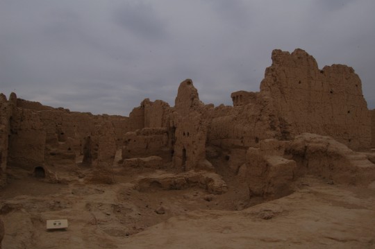
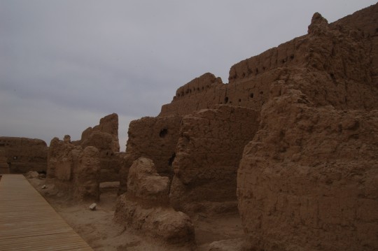
厢房
Side rooms.
In her book Essai sur la vie matérielle dans l’oasis de Tourfan pendant le haut moyen âge (Paris, 1973), which I repeatedly read as principle text for Archaeology in Turpan area, french scholar Monique Maillard suggested that the Grand Buddhist Temple is a multi-level structure based on the observation of holes lined up at near top the outer wall (3-5 m in height).
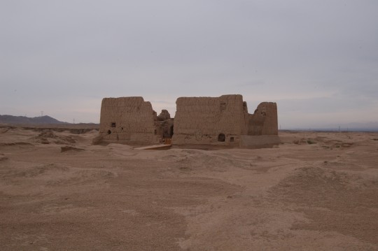
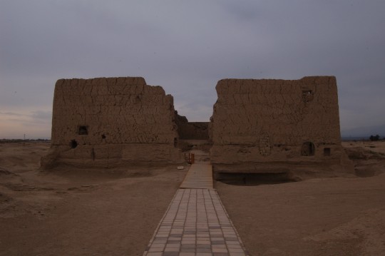
西北佛寺。
Northwest Buddhist Temple.
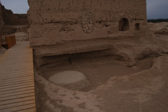
西北佛寺门边的水井。
Well.
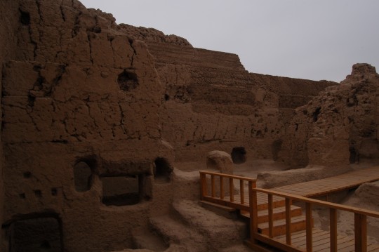
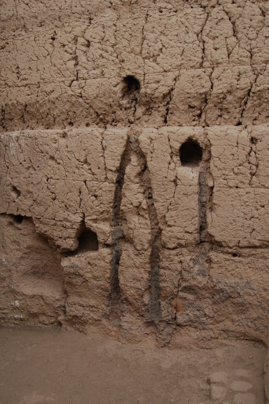
这显然是古代烟囱的遗迹。
Chimney. Soot residues are still visible, suggesting this room was used to be a kitchen.
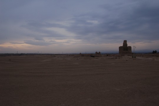
当我终于走到塔林时,被异样的天光笼罩。
When I finally reached the Forest of Stupa, the color of the dusk revealed near the horizon.
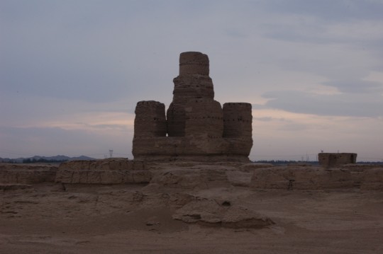
由100个小佛塔分为四组四个正方矩阵围绕的主佛塔。这些佛塔寄存着交河僧人的骨灰。
The main stupa at the Forest of Stupa. Its design resembles Bodh Gaya in India. There are 100 smaller stupas surrounding it, divided into 4 groups ( check Google Map for its unique layout) They were built as early as 5th century, containing ashes of Jiaohe monks.
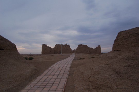
离塔林最近的寺院——东北佛寺。
Northeast Buddhist Temple, closest temple to the Forest of Stupa.
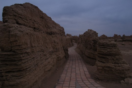
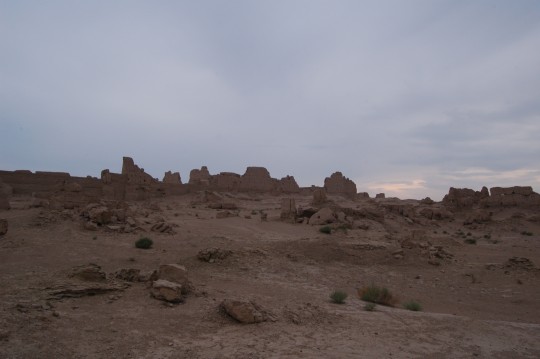
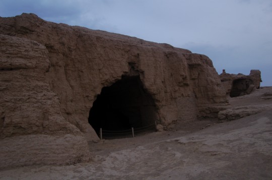
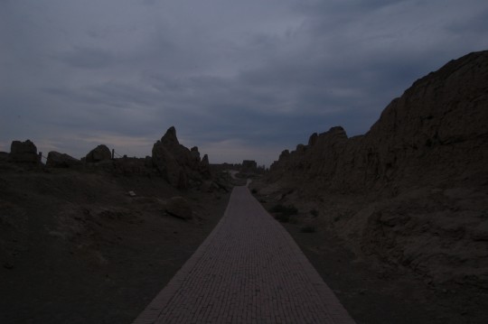
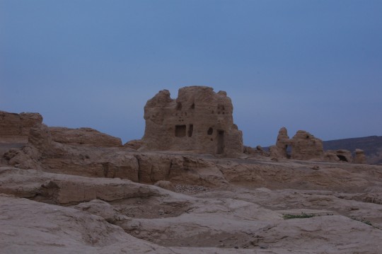
作为整座荒城中的最后一位游客,在天光彻底消逝前往南门赶,顺便再拍几张照片。在南门斜坡上,走过来的维族青年管理员说他正要来找我,说在监控里看我逛得真细,还聊了一阵。这天下午的游人真是不多。
I took a few pictures on my way back before the daylight eventually went out. When I approached the south gate, a young Uighur park ranger came and greeted me. He said he noticed that I did quite an intensive look of the site (comparing with average tourists I guess) and he was going to come to look for me as the site was closed. Obviously, I was the last one lingering on in the park’s monitoring system. A quite friendly guy, we chatted for a few minutes until I walked out of the gate and he got a call from his walkie talkie. If I knew it’s such a guy walking on the CCTV, I would have walked further.
DAY5 吐鲁番-高昌故城-哈密 (Turpan – Gaochang Ruins – Hami, 411km )
据《明史》,“火州……东有荒城,即高昌国都”。因为希望看完荒城能当天赶到哈密,我起得很早。高昌故城位于吐鲁番以东,胜金口以南。视频中能看到我是如何接近火焰山,如何错过一个出口而在高速上掉头,又一次穿过居民区和第一次绕行古代城廓废墟。
On this day, I set out early from Turpan, which was the turning point of my entire trip, and headed east towards the Flaming Mountains., This video depicts how I approached the Mountains, made a u-turn on highway, through another oasis town and drove a completed circle around the ancient ruins of Gaochang.
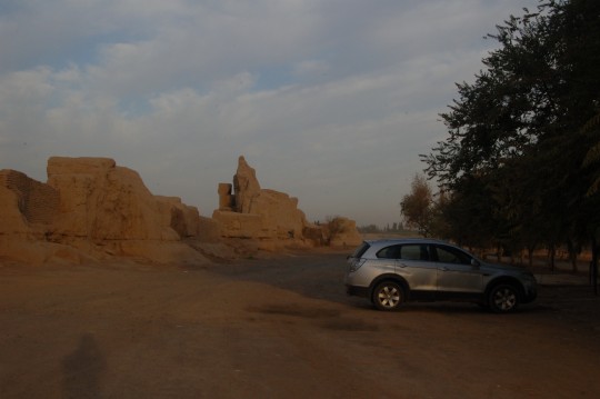
我在残破的城垣上一处类似仓库的铁门外停下来。门上找不到任何旅游景点的标记,连个售票亭都没有。我决定沿城墙行驶,看看有没有“正门”。
Gaochang Ruins (Google Map). I arrived so early, there’s no one’s here. There is no sign whatsoever. I found a warehouse-style gate with no public sign and wondered whether this is the public entrance. I then decided to drive along the wall to make sure.
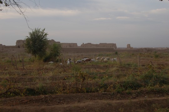
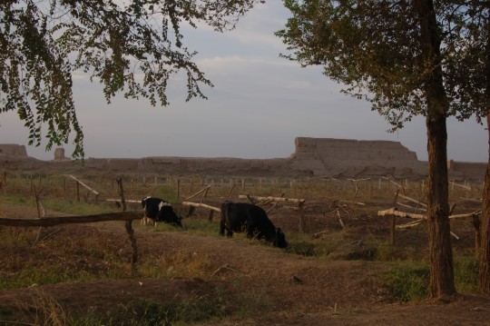
荒城周围是农田,动物们在朝阳下悠闲早餐。
The ancient city ruins, surrounded by farm land and animals grazing freely.
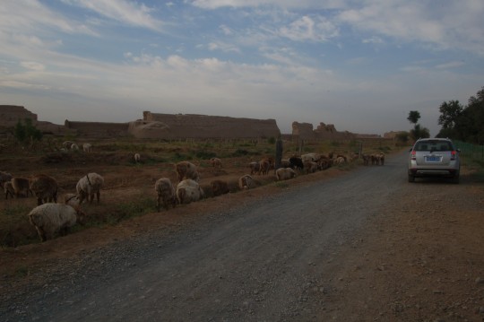
我沿着城墙绕城两周,其间和一位牧羊人交谈了一阵。虽然他不懂汉语我不懂维语,但他还是终于明白我说的是大门怎么还不开的问题。只见他掏出和汉人用的一模一样的图标花花绿绿的手机,终于让我明白这儿和“官方”时间有两个小时时差。高昌故城的开门时间,网上说法是八点,看来是本地时间。
I drove around the ruins for two complete rounds. At one time I stopped and chatted with a shepherd. Chat was not the right word since he couldn’t understand Mandarin Chinese and I knew nothing about Uyghur language. But I managed to make him understand I was asking why the gate is not opened. He took out his cell phone and make me understand there is a two hour difference between local time and Beijing time. Beijing time is the only official time and there is only one time zone in china, but obviously local people follow their own schedule. Tourism information in Chinese are usually full of commercials and spams. Not much useful information you can find on internet. Even those famed hot spots don’t have official websites.
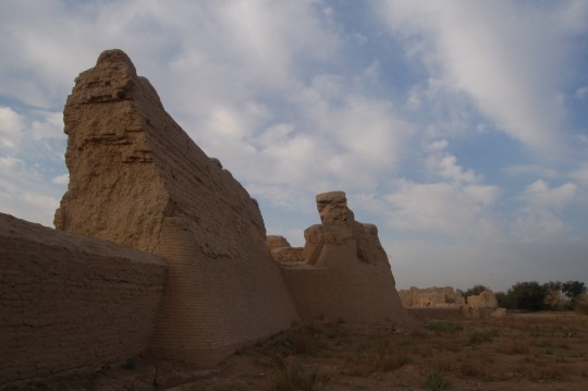
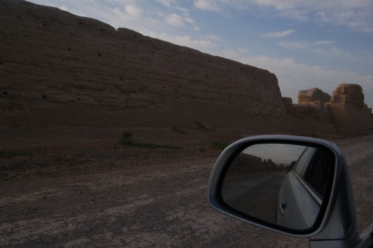
西墙。城墙上有不少被矮墙封上的大小缺口,应该是战乱和当地农民农耕和从城内取土肥田所致。
West walls. The walls have many openings, either damages during the wars or opened by local people – many nearby farmers collect soils from inside to fertilize their land.
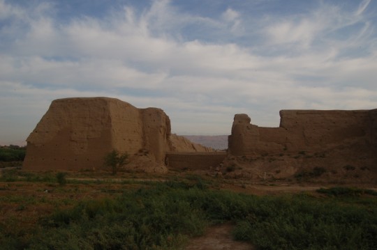
西南角。城墙之厚重可见一斑。这个角里便是大佛寺。
Southwest corner. Again, you can see the scale of the original wall, and the one built in the modern days to block the opening.

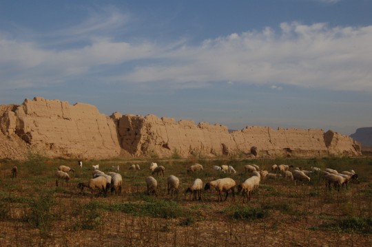
东南角,饱经沧桑的城墙和纯真的羊儿分享着平和。
Southeast corners. The ruins of city wall, with memories of seiges and destruction for many centuries, eventually reach the same state of peace as these lambs do. I stayed with them for quite a while.
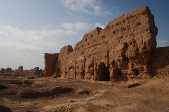
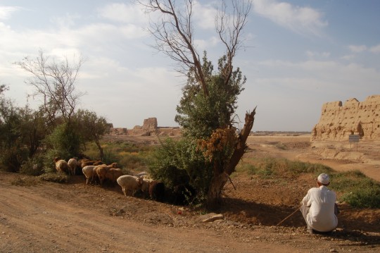
牧羊人遥望被开了个大口子的北墙。
A shepherd and his herds. Note that on the background, a large portion of the north wall was gone.
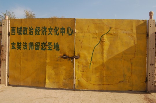
我最终买票进了城。我问工作人员有没有地图,他说门背后这个就是。还好,来之前已经翻了好几遍《古代高昌王国物质文明史》,卫星地图更是看得着迷。
问了问要不要驴车之后,他就出去把小门反锁,到树荫里乘凉去了。售票处是一张小学生用的双人课桌,可以很方便地搬走。
Finally I got into the gate. The official entrance of the ruins. The words on the left read “The political, economical and cultural center of the west land/the holy land where Master Xuanzang lingered“. When I asked the doorman/ticket seller whether I could get a site map, he pointed the map on the right. It’s ok as I’ve read the Maillard book and surveyed Google Map for quite a few times. After confirming that I declined donkey cab service, he left me alone with the city with the gate locked from outside, went back into the shadows of the trees outside. After wall, it was going to be a sweltering day.
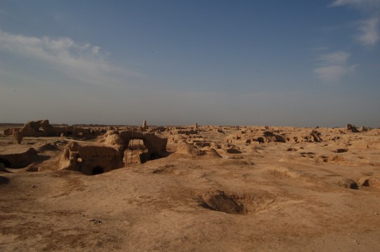
进北门不久,远眺南方的双塔。当年的高昌王国基本上就是一个汉人国度,连这座都城都是仿造长安构建的。
More than 2000 years ago, Han emperors already established military presence in the area. Later, when China divided into many small states, the county of Gaochang was ruled by different powers. It evolved into an independent kingdom, but during its entire duration, was basically ruled by Han Chinese ( Note: refers to ethnic group, different from Han as dynasty) and most of its people are also Han Chinese. No wonder the city of Gaochang was built with Xi’an as the prototype.
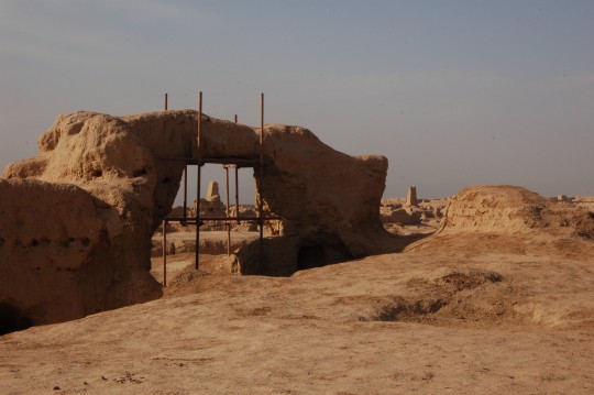
和交河故城一样,伟大的城市也有荒废的一天。高昌故城于十三世纪被废弃,饱经自然侵蚀和人为破坏。
The city was abandoned in 13th century and suffered great from natural erosion and human damage.
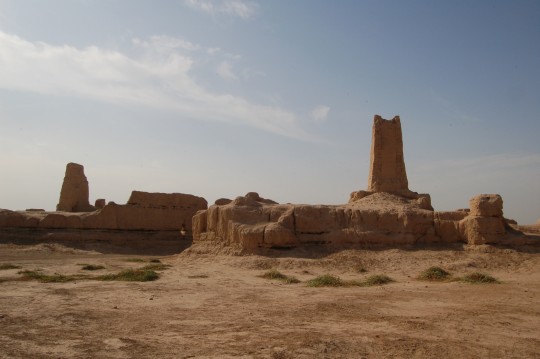
双塔之间,是被称为”可汗堡”的宫殿外墙。
The two towers are the most prominent landmarks inside the city. Between them are one additional wall, inside the wall (left, also left in picture below) is the area called Khan Fort. (Google Map for the spot I stood)
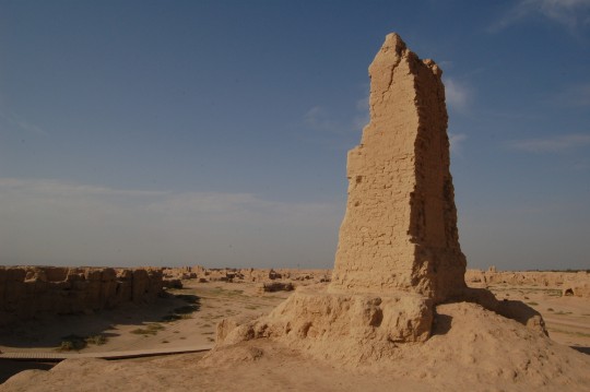
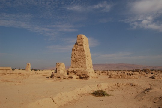
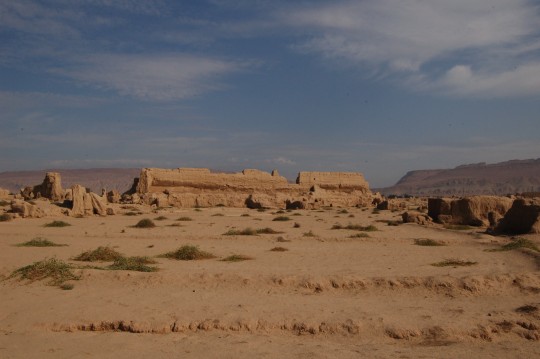
可汗堡外层的第二层墙是内城墙,部分残壁依然高峻,比如这一段。
Outside the Khan Fort wall is inner city wall, with a length of 3420m, remained maximum height 17m – this section should be one part. Very impressive.
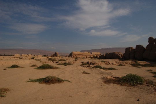
左侧是外城墙,中间和右侧是内城墙。
Outer city wall (left) and two sections of inner city wall (center and right)
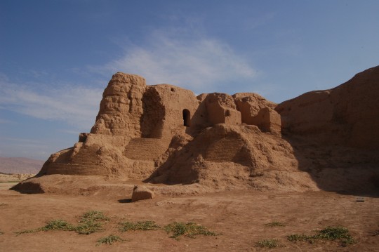
接近位于城内西南角的大佛寺。
Approaching the Grand Buddhist Temple on the southwest corner.
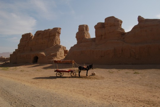
大佛寺附近,内城墙和驴车。
A donkey cab parked outside the inner city wall.
内城墙的“马面”结构,目的在于加强保卫。
This bulging component on the west side of inner city wall is called ‘horse face’, for additional defense.
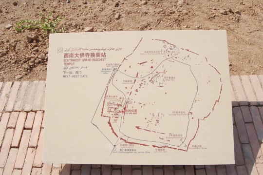
和大门上的地图相比,这类竖在地上的展板要专业得多,但后来我发现其中两块竟然放错了位置,而部分英文和中文完全对不上号。
There are a few maps sitting on major spots, looks much more professional than the one on the back of the gate. But later I found two of these panels are misplaced, and there are major errors in some texts.
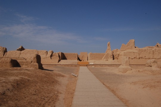
大佛寺是城内最知名的景点。在佛教极盛时期,高昌拥有三百寺院和三千僧侣。高昌王麴文泰对玄奘极其尊敬,曾趴下请求玄奘踏着他的背上讲坛。当然,他和玄奘的故事很多——企图扣留玄奘作为本国宗教领袖,玄奘绝食,最终二人结为兄弟。
Grand Buddhist Temple. Gaochang boasted more than 300 temples and more than 3000 monks. There was a long story about Xuanzang’s experience in Gaochang. He was sincerely welcomed and greatly honored by its king, Qu Wentai. Qun asked Xuanzang to be the spiritual leader of the kingdom but was declined. Qu attempted to detain Xuanzang, whom responded with a hunger strike. Finally Qu gave up and they were impressed by each other and became sworn brothers. Xuanzang stayed for quite a while in this city and without a doubt, he must have been in this grand temple. It was said that when Xuanzang stepped up to a forum to give lecture, the king lowered his body and asked Xuanzang to use his back as a step. Buddhism at its best day in Xinjiang.
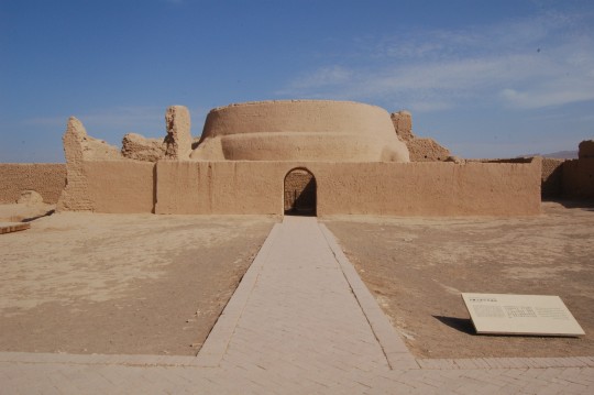
讲经堂。
This preaching hall is located in the north of the east-west axis of the temple. It has a dome built of adobe.
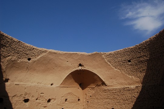
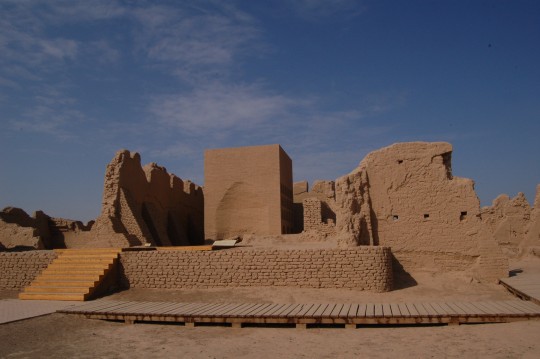
玛雅尔的书中提到,整座建筑由彩绘装饰,但如今只能使用想象去感受了。
According to Maillard, the entire building used to be decorated with colorful layers, but now they were totally gone.
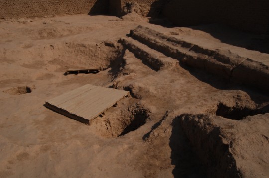
寺院一角的水井。
Wells near the southeast corner of the temple.
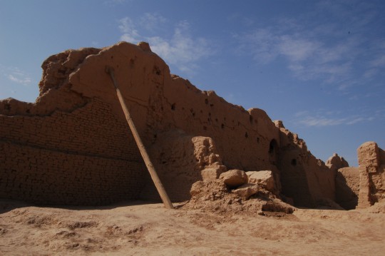
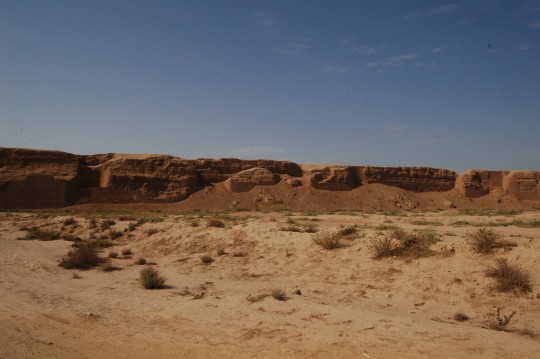
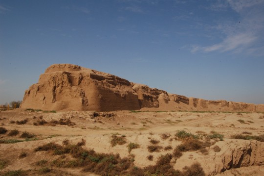
根据Maillard著述,格隆维德尔曾经在高昌城墙上发现过一些带有淡蓝色或淡绿色釉的砖,这令我想起柏林佩加蒙博物馆中的伊势塔尔城门。十九世纪,本地居民觉得这座废墟非常雄奇,认为它是神话中的国王达克奴斯建造的。
I didn’t walk close to the wall or attempt to climb it. It looks majestic too me. According to Maillard, in mid 19th century, local people admired the ruins so much, they thought it was build by Dakianus, mythical king of Turfan. Early western scholars Albert Regel and Dmitri Klemenz also named it ‘Dakianus – Chahri’ (The ancient city by Dakianus’). According to Maillard, Albert Grünwedel discovered some bricks covered with light blue or light green glaze. This reminds me of Ishtar Gate I saw in Pergamon Museum in Berlin.
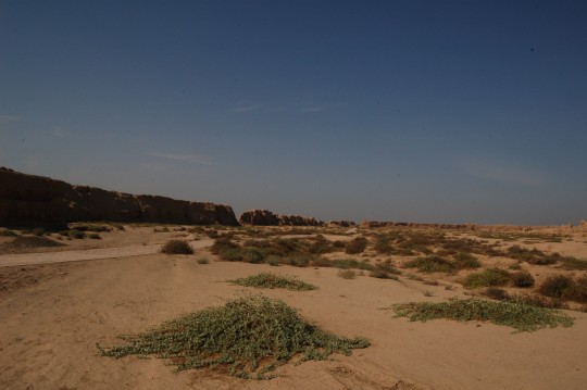
独自站在城中,我想象的是640年唐军的攻城。资治通鉴卷第一百九十五/唐纪十一: “君集命填堑攻之,飞石雨下,城中人皆室处。又为巢车,高十丈,俯瞰城中。有行人及飞石所中,皆唱言之”。《指环王》中的攻城场面大致如此。在此前,高昌王,唐僧结拜兄弟麴文泰认为唐军没有可能越过大漠远征高昌,但得知侯君集等大将带领数万唐军神速越过大碛之后竟然惊惧而亡。此役是高昌王国的末日。
(比这场远征更伟大的,还有高仙芝率唐军跨越帕米尔高原作战——斯坦因对那段壮举特别敬仰,认为高远胜拿破仑等一众西方大将。)
To me these walls are the most impressive part of the site. I looked around and imagined what happened in 640, when Tang army led by Hou Junji attacked this city. They used many gigantic equipment including catapult throwing boulders, and battering ram. The attacks were coordinated using observation tower on wheels more than 30m high. I can only imagine the siege of Minas Tirith. Reasonably, the city fell very quickly and brought and end to the Kingdom of Gaochang. It becomes a county of Tang Dynasty.
Indeed, the fact that an army of tens of thousands marched thousands miles through no-man’s land without local supply is huge logistic miracle. But Tang army did appear on the horizon quickly. According to historical document, Qu Wentai, the king of Gaochang, was astounded and died in anxiety when he heard the news.
This not the greatest march Tang army did. Gao Xianzhi, a famed Tang commander, led 10,000 crossed the Pamir Mountains to fight the Islamic Arabs. A miracle greatly admired by Stein (article), who already expressed the same admiration to the Chinese intelligence and endurance revealed in the construction of the Han Great Wall.
In The East Origins of Western Civilization (Cambridge Univ. Press, 2004) John Hobson suggested that by 1100 China had boasted as the country with most ‘intensive power’ in the world and the most advanced military technology only exceeded by the western countries in 18th century. Stein would certainly enjoy reading and supporting it if he had a chance.
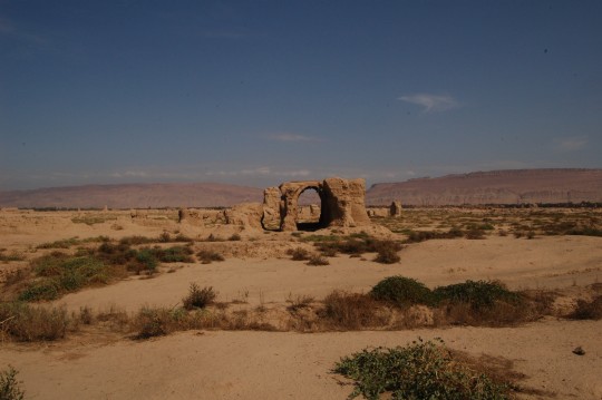
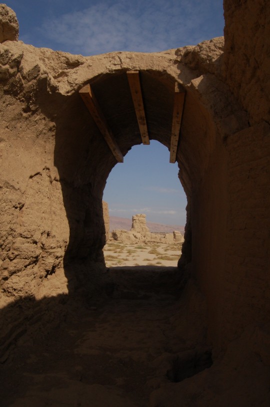
南部残存的极少量建筑之一。吐鲁番地区建筑的特点之一是因为缺少木料而使用圆拱。
One of very few buildings left on the south side. One common issue of local architecture is lack of woods, making frames and poles rare. Arch is one solution. The three wood columns are of course added recently to rescue the crumbling structure.
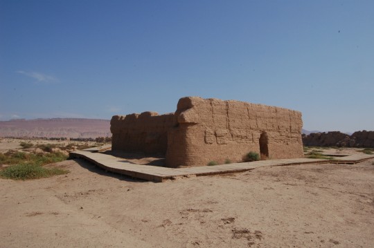
南部的二号建筑遗址。
Building Remains #2.
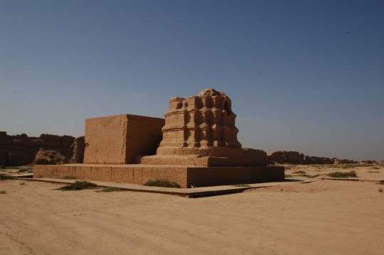
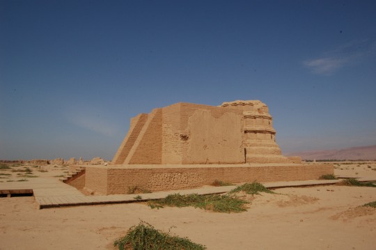
东南小佛寺。根据建筑形式和壁画风格分析,建于回鹘高昌晚期(12-13世纪)。
Southeast Minor Temple. Based on analysis of the style of the murals and shape of the pagoda, it was believed to be built during later Uyghur Kingdom of Goche (12-13th century)
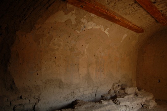
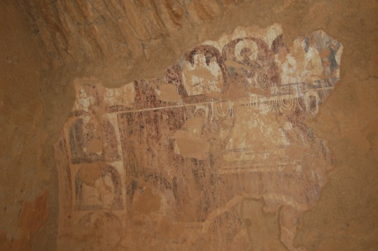
当我在小寺内发现竟然还有残存壁画时非常吃惊,还有些感动。毕竟,除了自然侵蚀,高昌故城乃至整个新疆的佛教遗迹都遭受了严重破坏,其中一部分是来自当地的穆斯林百姓。
I was very surprised and moved when I noticed that relics of murals are still remained on the wall. They were not suffered from natural erosion, but also damages from people from different religions. In fact, on many sites, buddhist murals and statutes were intentionally damaged by local Muslim farmers (one extremity of such behavior gained international attention was the destruction of Bamiyan). Buddhism has no place in this region in modern day, only massive amount of ruins like this indicating its past glory.
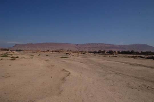
城内东侧已被夷为平地,在正午的烈日下,我似乎是在沙漠中行走,前方是火焰山。沙畹在《中国之旅行家》中所言,“是地小国甚多,沙漠中有水草之地即为一国”。
The east half of the city has disappeared. It became a long march in desert. The sun is still hot in a September noon. After all, Turfan is the hottest spot in China, has an ancient name ‘the Land of Fire’ in Chinese history. And the background is the Flaming Mountain, well known to all Chinese with the fiction Journey to the West, in which Xuanzang was stranded here by a wall of fire.
In his elegant book Les Voyageurs chinoi, French scholar Chavannes commented on the existence of many small countries here in the history: wherever there is water and vegetation, there is a city -state.
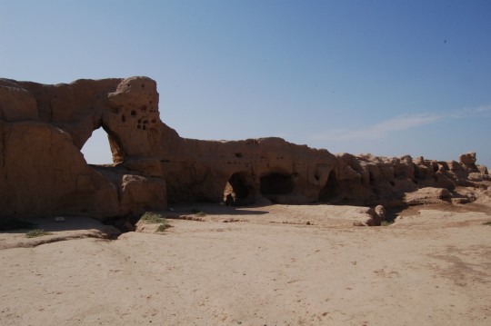
离北门不远的一段内城墙,残高已经很低,像冰淇淋般在历史的烈日中融化。
Not far from the north gate, an isolate section of inner city wall. The height been greatly reduced, like ice cream dissolving in the history.
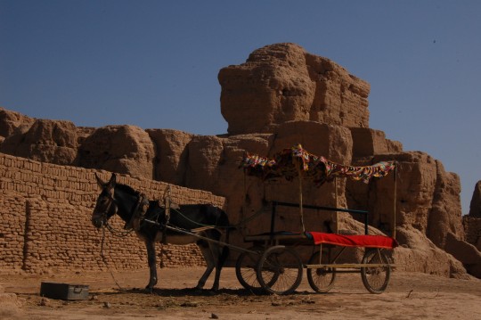
驴子对一个选择步行四小时的游客表示致敬。我所见到的几个游客都直接坐它拉的车到大佛寺转一圈就走了,一般也就三十分钟(也就是大门背后地图上的那条黑色路线)。
The donkey greeted me at the north gate. The entire trip cost me about 4 hour, while appears most visitors only stay at most 30 minutes ( no wonder this ‘typical’ route is marked in bold black on the map on the back of the gate).
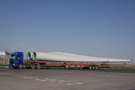
在看了太多土墙遗迹之后,在收费站重温现代科技。比驴车先进很多世纪。
After length tours of ancient ruins, sights of modern marvels were refreshing. But donkey cab has its place, too.
从胜金口穿越火焰山。虽然去过美国西部,这段画面还是令人难忘。
Across the Flaming Mountain via Sheng Jin Kou. Smaller and isolated than the Rocky Mountains for sure, I am still impressed by the beauty of the landscape (and the sudden maneuver of a tractor trailer before my nose at 10:55).
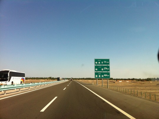
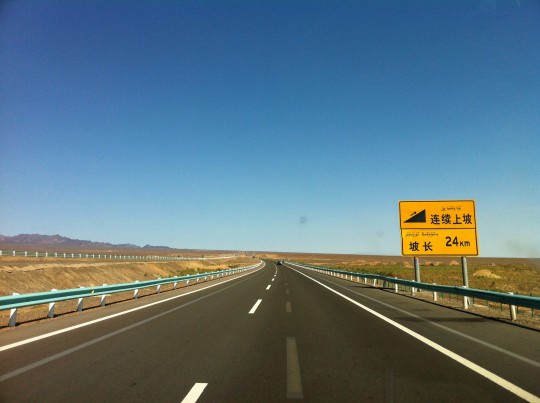
回程路上,向红山口攀登的24公里长坡。在红山口,执法人员告诉我,只有几个月驾龄是不能上高速的,我只好掏出麻省驾照解释一番。他看看我后座上的两堆书,让我走人了。
Heading towards Hami, before reaching the pass of Hongshankou (The Pass of Red Mountains), it’s a slope 24km long. At Hongshankou, I was told by a police officer that I was not allowed to be on a highway alone because I only got my Chinese driver’s license a few months ago. I showed him my Massachusetts and told him I have been driving on highways for more than 10 years without a single ticket. He took a look at my bookish passengers in safety belts and let me go.
穿越红山口
Through the Pass of the Red Mountains.
DAY6 : 哈密-罗布泊镇-哈密 (Hami – the town of Lop Nor – Hami, 800km)
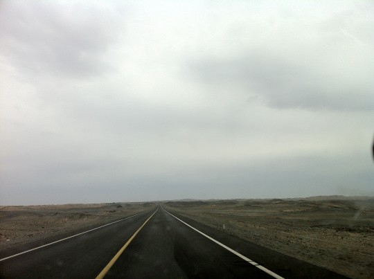
这天算是人生中不寻常的一次旅行。我一早从哈密南下,沿S235驶向罗布泊。斯文·赫定的”游移的湖”,如今早已干涸。感谢政府在罗布泊湖心附近修建了一个钾盐厂,才有了这条专用而且全程无收费站的公路S235,才使当天往返成为可能。有了公路,自然算不得探险,只是这几百里荒无人烟没有加油站的沙漠公路,独自旅行依然要小心谨慎。虽然前一晚已将油箱加满,我在最后进入荒漠前的哈密南湖乡还是转进了最后一个加油站想把油箱补满。工作人员告诉我他们只有柴油。与此同时,一辆工程车上满载的养路工人都好奇地围观我。
This day offered an unique trip to my life. From Hami to Lop Nor, it’s 800 km round trip across no man’s land. Fortunately, as a giant potassium salt production facility was established near the center of the dried lake, a road (S235) was built for it – a great (and absolutely toll free)benefit to visitors, although virtually no tourist goes there. Occasionally, people drove into the lake bed with their 4WD vehicles and called it expedition. Yet it is a slight risky journey to drive alone over such a long distance without a single gas station and service post on the way.
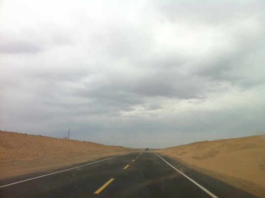
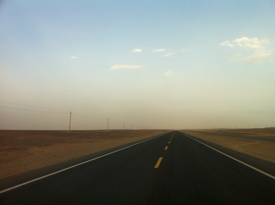
向南进发,强烈的侧风把沙子刮到公路上。
Heading south, I encountered strong side wind blowing sands onto the road.
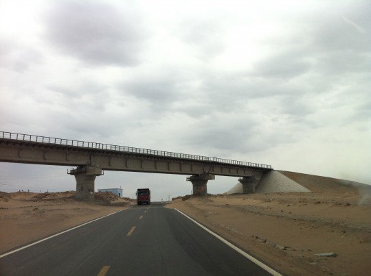
除了S235,政府还修建了一条运送钾盐的专用铁路。虽然造价每公里一百万欧元,但铁路运输比公路便宜一半。注意前方侵入的流沙。
Besides S235, the government also built a special railway to the industrial facility in Lop Nor. It is for freight train only and not open to public. Due to great difficulty in construction, Its cost was a stunning 1 million euros per km. But it will cut transportation expense in half. Hauling goods on wheels over such a long distance is certainly not cheap, not to mention the maintenance of such a desert road – note how the sands spilled into my way in this picture.
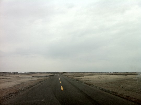
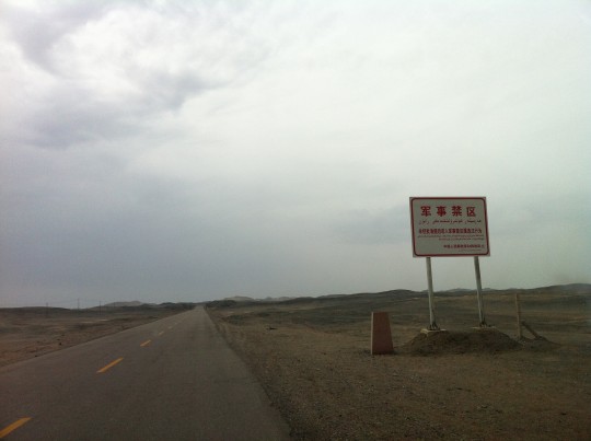
路过路上的最后一批人类建筑——一个铜矿之后,我彻底开始了火星探险模式。随即进入“军事禁区”。
After passed a copper mine,the last human post along the road, I felt like I entered the Mars. Then I came to this warning sign indicating a military zone. Lop Nor resembles White Sand or Area 51 in Nevada. In 1964, China’s first nuclear bomb was tested in this region.
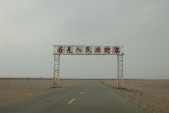
来之前在网上见过好几张这样“到此一游”式的照片。现在理解了:数百里了无人迹的跋涉后,突然看见这样一个标记还是很激动,感觉真的受到了盛大欢迎。若在古代,也许会看见“楼兰人民欢迎您”的牌楼,让饥渴的旅行者勇气大增。
I saw this welcome sign (People of Ruo Qiang County Welcome You!) a few times on the internet, posted by people ever visited Lop Nor. Now I know why this worth a shot, after absence of any man-made object except for telephone poles along the road in a span of a few hundred kilometers. I did feel a very warm welcome. Reasonably, it’s very easy to get lost during ancient time when there is no permanent road and navigation system.
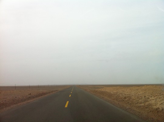
公路开始下沉到盆地中。整个罗布泊地区曾经是古代海盆。
The road starts to dip into a lower basin. The entire area used to be part of a vast sea bed. And Lop Nor is a salt water lake thousands of miles from any modern sea.
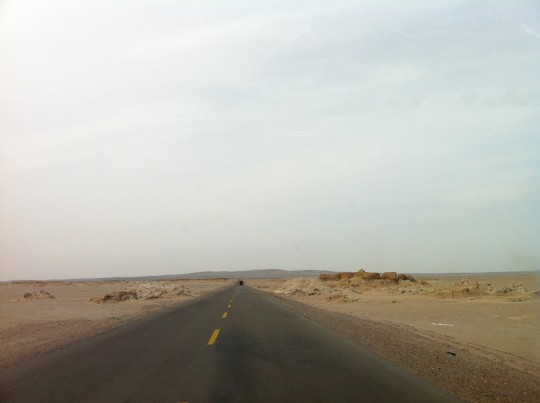
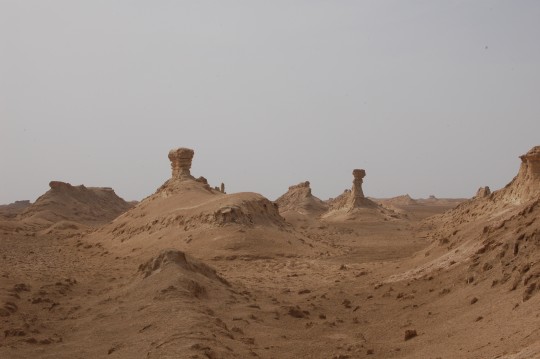
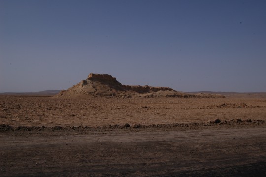
雅丹地貌开始浮现。
And Yardang landscape start to emerge.
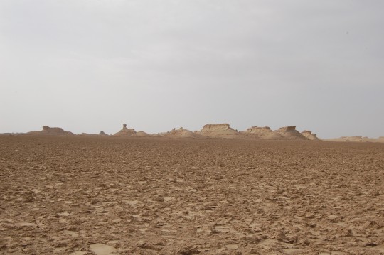
终于,我在地平线上望见了此行最想访问的景点——白龙堆。奔袭数百里为了看一些大土堆已经不是今生头一回。这些土堆照例没有游客光顾,但却早已名垂青史。
Finally, I saw it floating on the sea of salty crusts. The White Dragon Mounds. This is the ultimate destination of my entire journey of the northwest. It’s not the first time in my life driving hundreds of miles just to see a few mounds. There is no banner, ticketing gate or a single visitor around, but theses mounds stand still in Chinese history.
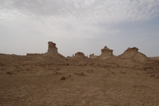
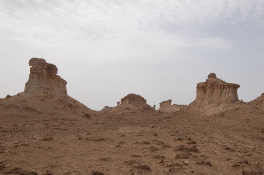
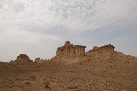
虽然在遍布锋锐的盐壳地上(独自)行驶有一定风险,但还是把车开到了白龙下,并且爬上了龙首。我曾经在很多文本的只言片语中想象这片奇观。法显简洁动人的描述。各种各样的古代史籍,赫定和斯坦因的游记。
法显西行和玄奘东归,都经过了白龙堆。过去几天循着他们的足迹一路行驶,至此目睹眼前的景象,对这两位高僧的敬意无以复加。如今已经变得轻浮的“旅行”二字,曾被他们赋予深邃的意义。
The salty crusts on the ground have been hardened and sharpened by strong wind and harsh sun for thousand of years. Driving on them can be risky. But I was still determined to approach these mounds and climbed some of them. I have envisioned such scenery for many times, with brief yet vivid writings from my greatly respected monk Faxian, multiple traces of lines from various Chinese historic records such as Wei Lue, and my ‘handbook’ style travel logs by modern scholars such as Sven Hedin And Stein.
Across these mounds was the road Faxian traveled to the west to India, and Xuanzang traveled back from India to Xi’an. I followed the roads they traveled. Besides fulfilling my amateur interests in combining geography and history, these two masters unleashed profound meaning behind the word ‘travel’, which I found more or less frivolous in young people these days, and above all, not a Buddhist myself, their deeds greatly reinforced my respect to Buddhism.
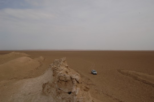
我爬上了其中一条龙的龙头。车在干涸的海洋中留下优美的尾迹。注意雅丹上的白色盐迹。
Off my vehicle and climbed onto the head of one dragon. The large area used to be vast sea bed. Note the white salt on the mounds, that why they were called ‘white dragons’. Their bodies were carved by year-around harsh northeast wind.
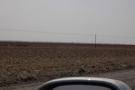
继续南行,白龙堆在路东排列,在海市蜃楼中状如一片巨大的城市。白龙堆雅丹长100公里,宽20公里,东北西南走向,横在汉玉门关和楼兰之间,是古丝绸之路中道必经之处。楼兰是我梦想中的去处,但作为一个独行的旅行者,没有更好的车辆、专业GPS、卫星电话和充足补给,我只能继续将它暂存在梦想中。
Mirage of the Mounds lingers on for many miles on the east horizon like a large city. The span of the Mounds is about 100km long, 20km wide, that’ s why the ancient road had to traverse through it as it lies between Yumen Pass and ancient kingdom of Loulan, a crucial stop for the Silk Road re-discovered by Sven Hedin in 1900, a dreaming site beyond my reach as a lone traveler without better vehicle, professional GPS, satellite mobile phone and abundant supplies.
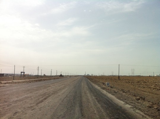
即将抵达罗中镇。最后这一百公里路虽是铺设的,但破坏严重,即便低速行驶依然异常颠簸,我非常严肃地准备捡拾散架的零部件。
Approaching the town of Lop Nor(Luozhong,Google Map). The last 100km is still paved road but has a miserable condition. My vehicle made violent vibration even in low speed, I was seriously concerned that some parts would fall apart.
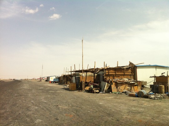
这并不能算一个城镇。路边只有数间简陋的小屋提供简单的食品、机修和住宿,顾客都是过路司机。旅游二字与此地无缘。
This is not a real town. Only a few shacks provides rudimentary food, mechanical repair and beds to passing truckers. Tourism is the last word you want to related this area to.
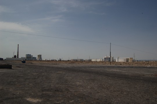
路对面的钾盐厂倒是气势非凡,但不对公众开放,访问据说还要审批。网上说假如要进湖心或去楼兰,要到镇上派出所登记,还说过去几年该派出所的相当一部分精力都花在救援被困罗布泊的探险者了。
The potassium salt production facility boasts some brand new structures, but no service is provided to public. In fact, permission is required from authority for a visit. If you want to go further south along the road into Lop Nor or Loulan, you need to go register on local police station, beside likely concern of military secret, this is also for your safety, according to their statements. There were reports that the major task of this police station has been rescue of explorers from the desert.
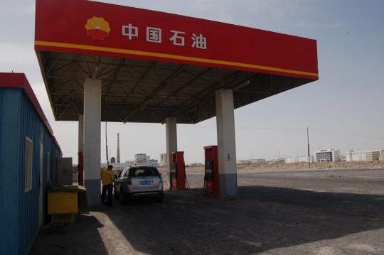
这是今天看见的第二个加油站(第一个在将近四百公里外的哈密南湖乡)。这位工作人员是我在这座小镇看见的唯一人类。如果没有这个加油站,我会带上二十加仑汽油。
The second gas station I saw today. When I arrived, no body’s around. Then the service man appeared from an underground bunk. He was the only human being I witnessed in the entire town during my 20 minute staying there.
The first one was 379km away in south sururban Hami. I have filled my tank the day before, but still went to that gas station to add a bit. The employee the gas station told me they don’t have gas, only diesel. A utility truck of road workers gave me an uniformly strange look.
If there were no such gas station near the center of the lake, I’d still come, but with additional 20 gallon of gas in my trunk.
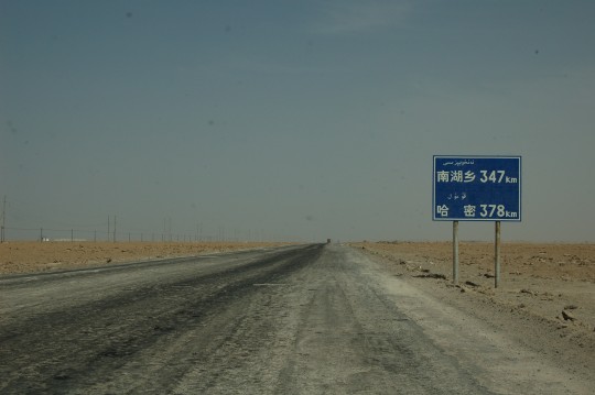
循着被破坏得匪夷所思的道路朝哈密回返。
On the rough road back to Hami. 378km to go. Why the paved road has such weird damage is beyond my thoughts.
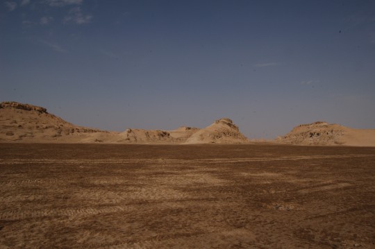
我在盐壳地上发现了一些拖拉机履带的痕迹,决定沿着它深入靠近白龙堆南端,也就是龙尾的位置。盐壳被重型车辆压过之后,扎胎的可能性应该变小。
I found there were caterpillar tracks, drove over them (figured it should be less risky) and got close to the south end of the Mounds, where the tails of the dragons are.
巡行在白龙堆西南端。 这段视频提供了更立体的地貌描述。拍这段电影的时候我彻底了解了野外电影工作者的艰辛。
A ‘3D’ description of the Mounds of White Dragon, especially the majestic tails. Short, but took myself some effort.
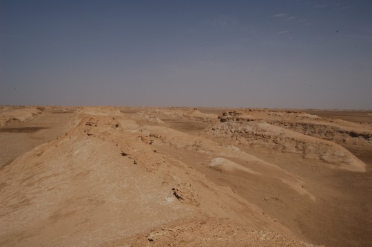
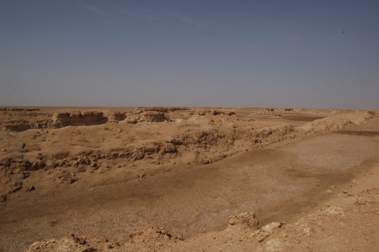
在龙尾上向东北和西北望去。
Climbed over one of the dragons, view northeast and northwest. Again, the direction of all dragons are northeast (head) – southwest (tail), is the result of year-around northeast wind. The ancient Silk Road crossed the Mounds from east to west, people needed to traverses through all these maze-like mounds and frequently climb over them. No wonder so many texts called the Mounds ‘hideous’.
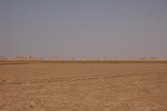
在返回公路前的这张照片上,是无尽排列着的龙尾。
Before I headed back to the road, I took a final shot on the endless dragon tails in the northeast.
S235有一小段直接穿过了几处雅丹,我在这儿看见了南方某大城市青年商会为自驾游而树立的石碑,上面只是大串的人名。·来之前,我已经阅读过罗布泊湖心竖碑砸碑的闹剧,现在发现我可能属于砸碑的那种人——一帮驾驶四轮驱动空调越野带着家眷啤酒烧烤器材的社会精英,竟然在这个古代徒步旅行者循着前辈枯骨跋涉过的地方立碑,而即便是法显和玄奘,也只留下了“沙行艰难,所经之苦,人理莫比”这样的只言片语。高僧是为高僧,而不堪教育的酒囊饭袋即便是去过世界屋脊,依然是酒囊饭袋。
A section of road actually cut through a few mounds. Here I found an monument established by a young businessmen’s club from south China celebrating their road trip. How superficial, as this is where ancient monks and traders on their feet in the hard journey to the west passing endless skeletons of previous travelers. People in 4WDs with beer and BBQ sets in trunks has nothing to celebrate. Erect a stone inscription in such a historical public land with your name on it? Read some books.
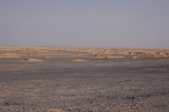
白龙堆最北端。龙身已经变得很小了。
North end of the Mounds, where the dragons are much smaller, with the maze-like patterns they formed more visible.
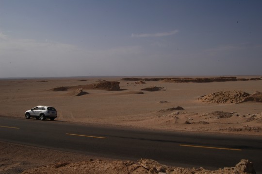
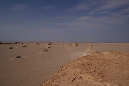
最终,只剩下浮出沙海的龙头。
On the north side of the road, dragons are almost completely succumbed to the power of nature and time.
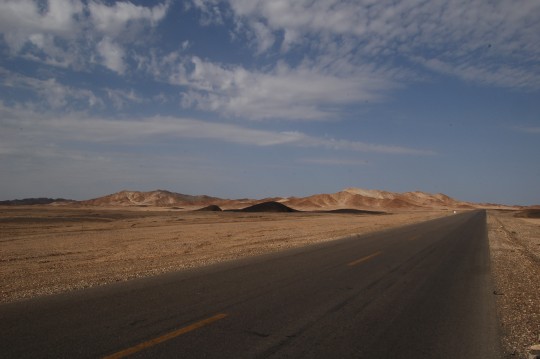
穿越觉罗塔格、库鲁克塔格东部低山丘陵地带。当地表渐渐变绿,我会经过土屋铜矿。
Drove across the colorful east lower lying parts of Qoltag Mountains and Kuruk-Tag Mountains. Soon I would approach a green landscape where the large copper mine is located.
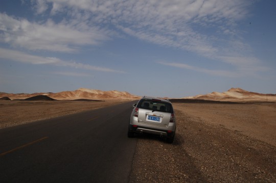
在旅途中,我总是更乐意为辛苦奔波的旅行伴侣留下影像。特别是在如此广阔的风景中,在拥有深远历史的路上,任何人像都微不足道。
For years I never took pictures of myself, as a personal portrait is destined to be dwarfed by vast landscape and depth of history. However, I would always memorize my travel companion whom I established a special bound upon resolution and sometimes hardship.
The colorful mountains under mild sunlight was the a bonus I got for my love of barren landscape.
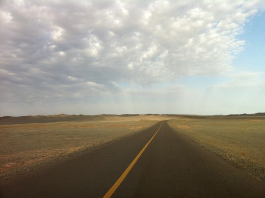
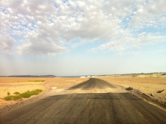
G235的不少路段还是非常平整,但不幸的是其中有众多的排水沟因为被重型车辆碾轧而塌陷成一道天堑,只有把车速降至最小才能通过。
While sections of G235 have a good condition, many drainage tunnels through under the road were damaged by overloaded trucks, forcing me to zero my speed from time to time.
在回到哈密南郊前,遭遇了一场沙尘暴。在公路西侧几公里处的沙漠中目击两处貌似龙卷风的沙尘柱,车身被砂冰雹般的砂石敲打。路对面有一辆大货车的车窗被砸得粉碎。
Approaching Hami, I drove cross a sandstorm. On the southwest of Hami, there is a small but well known desert. The wind was very strong, spewing pebbles onto my doors. I saw a truck with front window totally shattered.
回到哈密市区时天又放晴,我顺小路进城。看起来沙畹所称的这些沙漠城邦都很相似。
Back to Hami, the sky become clear again. I switched to a small street and found the scene much resembling Turpan, another oasis town.
DAY7 哈密 – 永登 (Hami – Yongdeng, 1230km)
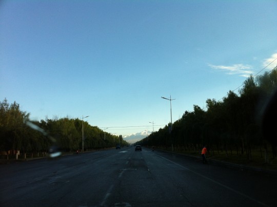
从旅馆出来北行上G030时遭遇了严重的堵车——这座小城也有上班高峰,而一条横穿市区的兰新铁路严重限制了南北交通。当我驶上八一大道北望,发现天山上一夜之间多了大量积雪。广播里反复播放着降温消息。
When I left Hami and headed north to G030, I noticed the first snow fell on the Tian Mountians overnight. Radio broadcasted alert for dramatic temperature drop.
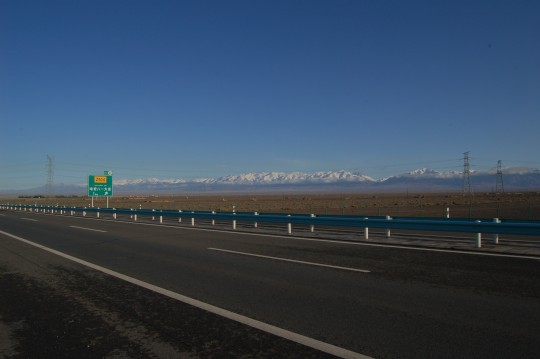
重访莫贺延碛和五烽,想象玄奘经过此处时目睹的场景:“四顾茫然,夜则妖魅举火,灿若繁星,昼则惊风拥沙,散若时雨”(《大慈恩寺三藏法师传》)。
Passing Moheyanqi again. When Xuanzang passed the desert in the darkness, he saw evil spirits with torches in their hands, lights all around like a bright starry night. And the Master just kept on walking.
穿过星星峡。
Through Xingxingxia ( the Gorge of Stars). It’s said to be a good place for stargazing. Same stars Xuanzang witnessed in the desert?
过柳园。能看到显著的地貌变化。
Before and after Liuyuan. You will find it a dividing point for two different landforms.
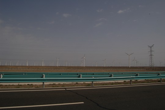
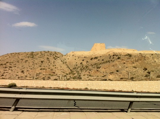
虽然这是赶路的一天,我还是被路边的风车阵列和烽火台吸引。
Even this was a non-stopping mileage-conquering day, I was still mesmerized by windmills and beacon towers.
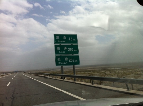
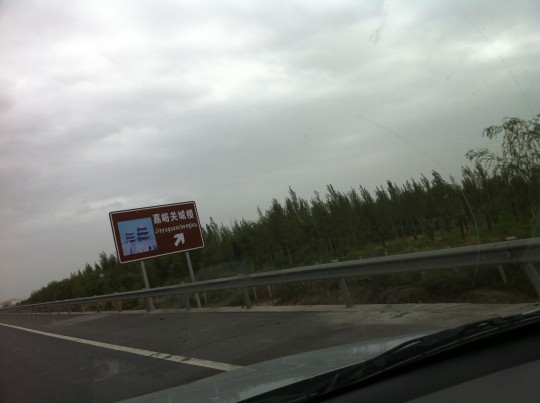
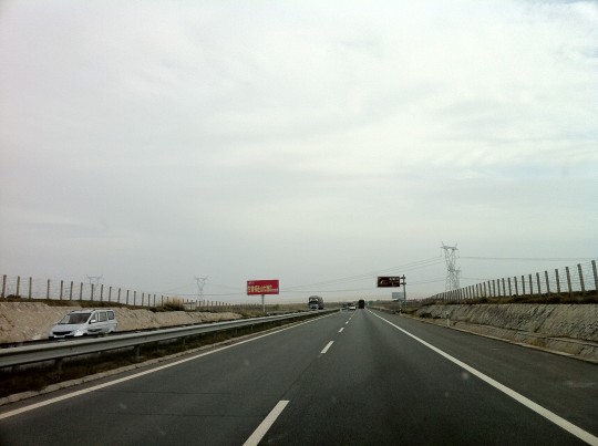
和五天前相比,嘉峪关附近的能见度更糟糕。在嘉峪关市南,G030从地下穿过了已经不存在的长城。
The area new Jiayuguan had a even worse weather compared to 5 days ago. At certain point south of Jiayuguan City, the highway passed under the no-longer-existed Great Wall.
穿越乌鞘岭。当穿越最后一个隧道之后,一轮圆月(33:54, 37:32)提醒我明天就是中秋了。日行1230公里并没有打破自己2009年在北欧连续行驶1400公里的记录,但假如在兰州和秦岭之间有合适住宿的城市的话,应该能够再开几百公里,争取多一点时间在西安停留。
Through Wuqiao Mountains. After I exited the last tunnel, I noticed the bright full moon(33:54, 37:32). It’s one day before The Mid Autumn Festival. 1230km for today did not break my past daily-driving records of 1400km across Scandinavia in 2009. If there is a reliable place for accomodation beyond Lanzhou and before Qin Mountains, I would certainly drive 1500km, to win more time staying in Xi’an.
DAY8 永登 – 西安 (Yongdeng – Xi’an, 719km)
路过兰州。
Passing Lanzhou and the Yellow River (fully visible at 31:35).
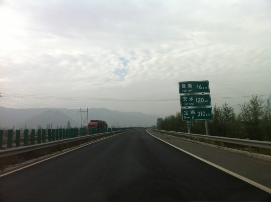
又准备穿越秦岭。它位于天水和宝鸡之间。
Again, I prepared to cross the Qin Mountains, which lies between Tian Shui (120km) and Bao Ji (310km).
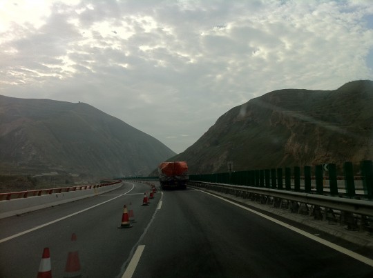
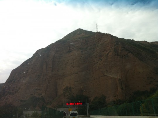
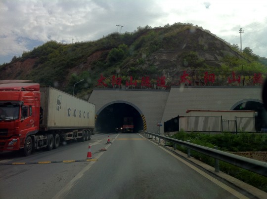
照例,又要经历排在众多载重车辆中的单车道龟速前进。在某处塌方开裂的路段,前面的大卡车几乎是试探着前行。
And again, on narrowed highway, among heavy tractor trailers and through many tunnels. At times in the landsliding sections, the truck drivers before me were obviously in heavy doubts when they cautiously passed the cracking pavements in slow motion.
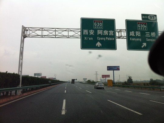
回到西安。这是斯文赫定最后一次考察的终点,他的第175号营地。我的8号营地。
Approaching Xi’an, where I started this journey. I exited at Epang Palace exit, which named after the great palace of Qing Shihuang, the great emperor who unified China and started building the Great Wall. He is mostly well known overseas by his Terracotta Army.
Xi’an, the capital of Han and Tang Dynasties among a few others, used to be the largest city in the world for a few hundreds years. Sven Hedin finished his last China Expedition here, which he referred as Camp #175 (The Silk Road, 1938). My Camp #8.
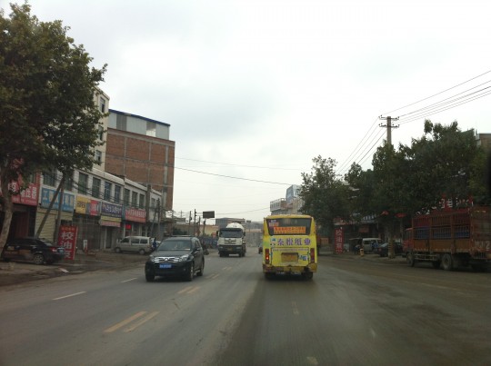
在阿房宫出口下来其实是GPS的错误。这导致我必须开车走普通街道进城。昔日的世界最大都城,城乡结合部也呈现出一种令人感到亲切的混乱。
Exiting at Erpang Palace was actually an error misled by GPS. Obviously, I saw no magnificent palace but was stuck in local traffic on small streets. Too later to get back to a highway, I proceeded in this traditional Chinese traffic style, took it as a welcome-back from the empire to its exiled resident.
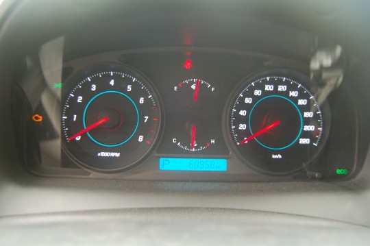
八天行驶6095公里。因为车身上都是土,还车时工作人员草草检查了事,还问我是不是进藏去了。哦,不是,下次吧。我没告诉他这些土来自白龙堆,还把车里剩下的大量瓶装水送给了他,本来是预备着在沙漠中抛锚保命用的。
In 8 days, I traveled 6095.8km plus a few more miles on foot. My vehicle was full of dirt and car rental agent gave up the inspection. I didn’t tell him the dirt was from the Mounds of the White Dragons, as not every Chinese knows about it. I left a large amount of bottled water to him – those are kept in the trunk in case I am stranded in the desert.
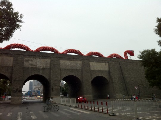
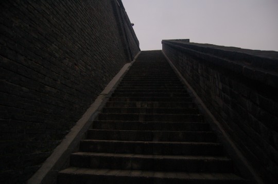
貌似大多数出租车司机都不爱进“城”,所以我被拒载了十次。终于在酒店放下行李,就出来直奔城墙。
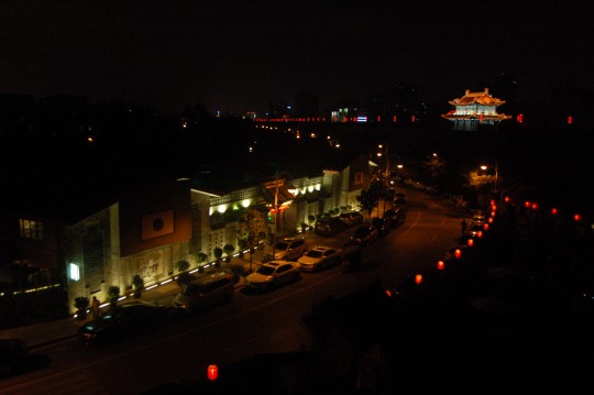
After checking into hotel, I promptly head out to see the city wall – I didn’t have much time in this city and the city wall was the only thing I wanted to visit. But what’s this nonsense on the top of the Peace Gate?
售票员告诉我,虽然七点关门,但城上游客可以呆到十点。我立刻就感到今晚有着落了。
I was told the ticket office will close at 7PM but visitors are allowed to stay on the top the wall till 10PM. What a relief.
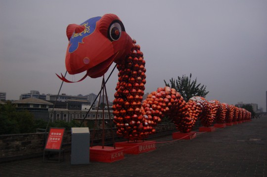
Not a dragon. A snake. 2013 is the Chinese Year of Snake.
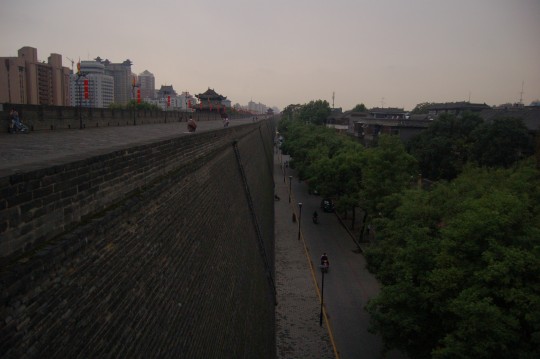
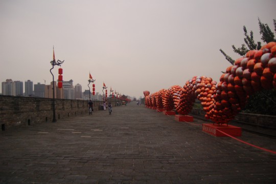
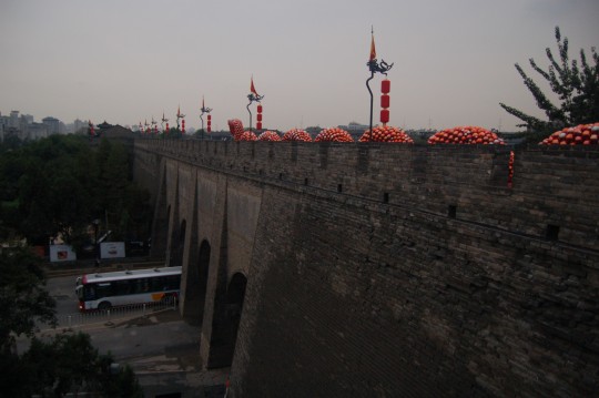
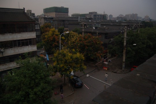
The ancient city wall is surrounded by high-rise buildings. Inside the wall, fortunately, building height is limited.
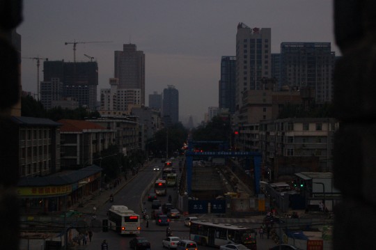
大雁塔,为存放玄奘西行取回的经文和佛像而建。
The tower-like structure at the south end of the road, which I climbed in 1997, is Giant Wild Goose Pagoda, built 1400 years ago during Tang Dynasty to store scripts and figurines brought back from India by Xuanzang. The age of the current city wall is much younger – it was build during Ming Dynasty,more than 600 years ago.
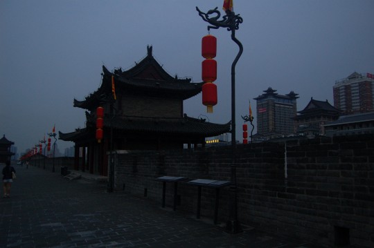
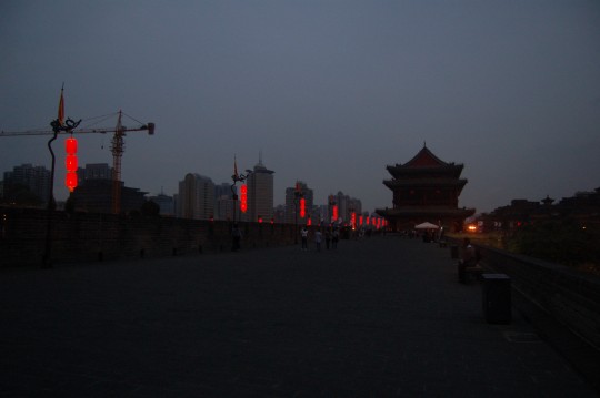
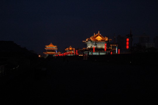
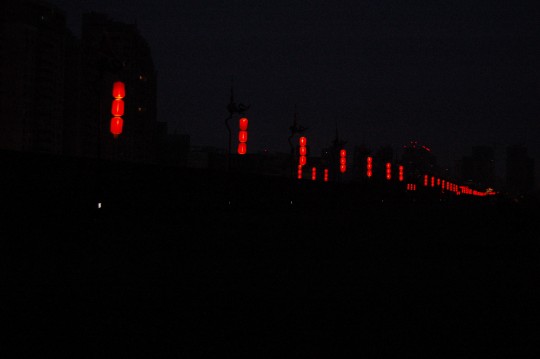
本来因为没能赶上好天光而遗憾,但等灯笼都亮起来,我发现自己置身于一个奇幻世界。但这应该就是人类拥有电灯前的真实世界。
After the darkness fell, I realized I am in another brand new surreal world. This is actually what the world looked like before electricity and Edison.
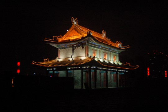
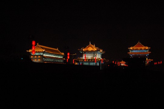
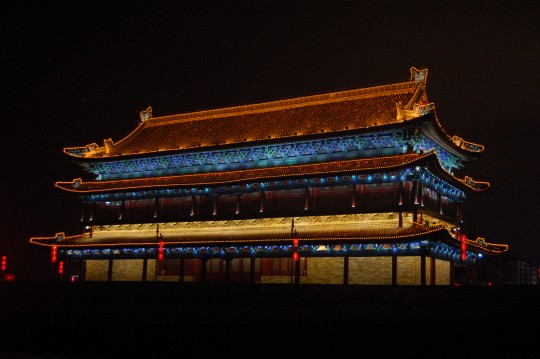
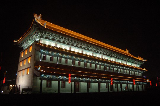
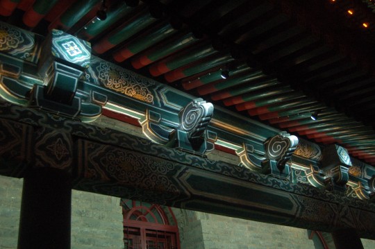
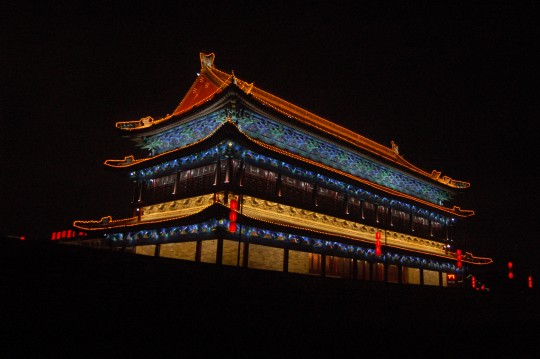
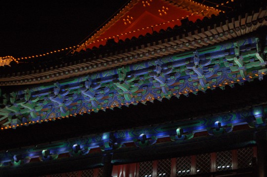
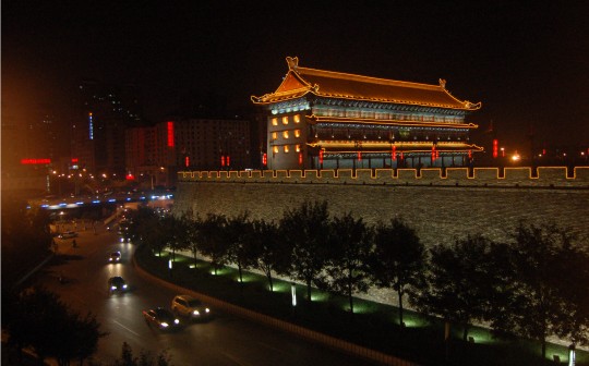
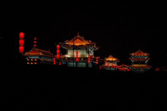
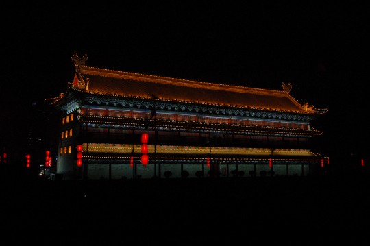
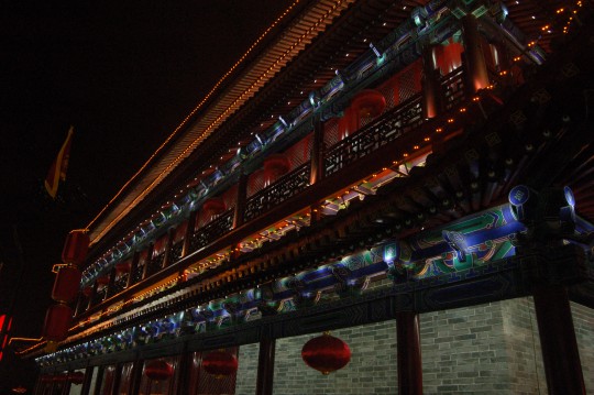
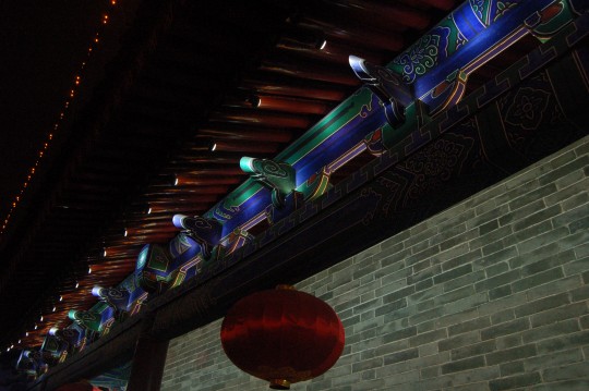
这些美景,应该是古都对一个走过丝绸之路看尽沙漠废墟的旅人的额外奖励。
上次来到城墙上是97年,也是在一次丝路之旅后。当时城墙还没有连通,我不得不翻栏杆。这次城墙可以走通了,还可以租自行车。我花了两小时在城墙上骑行了一周。很多时候是独自一人在黑暗中,完全靠这些灯笼和城楼引路,感受着城砖带来的颠簸。
These sophisticated forms, shapes and lights must be a bonus offered by the ancient capital, to a traveler experienced only ruins and sands along the Silk Road.
Last time when I visited here (also after a shorter journey along the Silk Road) in 1997, the wall was divided into sections. I still recalled I had to climb over some fences in order to get through. Now I found the city wall is completely connected and allow traffic of rental bicycles. I was amazed to see so many happy people biking on the wall. I myself quickly got one and completed a circle on the wall in less than 2 hours. That’s a distance of 13.7km, on the top of this grand ancient architecture. Most time I was completely in darkness only these exquisite lights leading me the way. Besides the lights, I still remember the feels of the ancient wall bricks under my wheels.
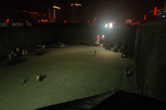
和嘉峪关一样,每座城门都拥有瓮城。
Just like Jiayuguan, each city gate here has a wengcheng ( a close western equivalent is barbican). In this one I saw a few vehicles, a few drums and a line up of ancient weapons, and a small gift shop.
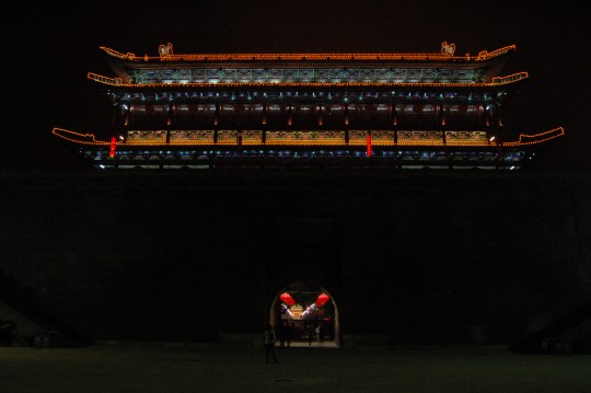
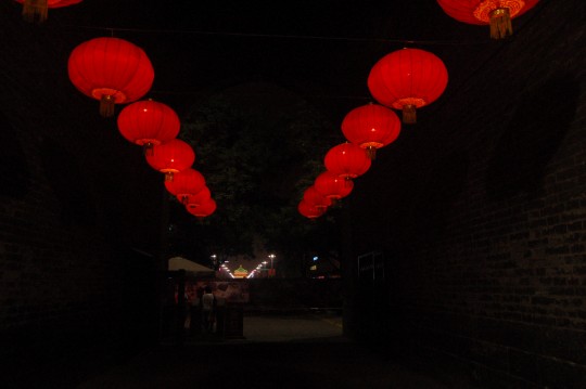
从南门里望去,能看见钟楼。
View north from the south gate, the Bell Tower can be seen in the distance.
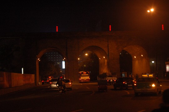
The gates where the modern traffic goes through.
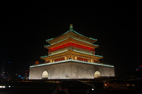
钟楼。
The Bell Tower. Actually you don’t need to know anything about it. To view it is a feast of vision.
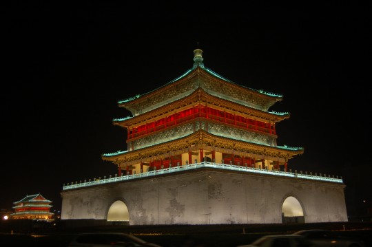
以鼓楼为背景的钟楼。
Viewing from southeast, the Drum Tower is visible on the left. Both were built in Ming Dynasty. It is a Chinese tradition for the cities to ring bell at dawn and beat drum at sunset. Beijing also has one bell tower and one drum tower, standing close to each other.
DAY9: 北京 (Beijing)
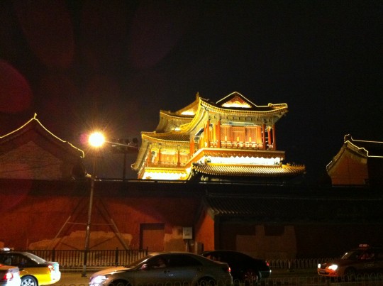
回到北京,在酒店门口看见富婆指指戳戳着训斥唯唯诺诺的保安时,才感到真正回到当代中国。还好,我在这儿只是一个过客。晚上十一点去见几年没见连手机号都记不得的老友,到了雍和宫外一处新开的酒吧街,尝各种欧洲啤酒,讨论崩溃的盘市,想起来路上喝过的黄河啤酒,应该是黄河水酿造的?两点多乘出租车回海淀,转眼就到。北京是个很小的城市,并且在我记忆中继续浓缩。
Yonghegong (Yonghe Temple) is a temple of Tibetan Buddhism in Beijing. I didn’t visit it but only viewed it from a streets full of newly opened bars, where I met with an old friend. Such an combination is my typical memory of the national capital.
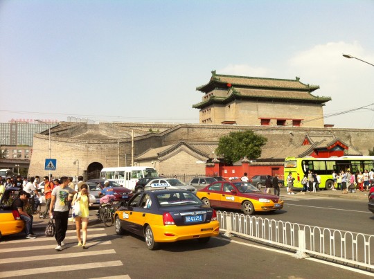
第二天午饭后,和掘火的两位离休编辑一起走到德胜门。这座城楼护佑着一座城市,而千里之外戈壁中的城墙,则守望了一个国家。我又想起来,我还是没去过故宫。但下次肯定还是没时间,因为我肯定还会继续奔向边疆。一个国家如一本书,看边缘才知道它的厚重,封面上的鎏金只是浮云。
Deshengmen, one of the few preserved ancient city gate of Beijing. With quite a couple of years of my life spent in this city, the fact that I haven’t been to its center, the Forbidden City , is a myth. However, next time I would still prefer to visit the frontier of the country – just like a book, only when you view it from the edge you know its weight.


看來我「不是」國民,所以大部分「常識」我都沒有哇~
但這旅程讓我看來……倒沒有「興奮」,如果是我,我會很害怕。
喔~就讓我繼續當阿宅吧。
套一句阿蘭說的:
「以高速度周遊世界的人,倦遊歸來的腦子裡保存的記憶不比他出發時豐富多少。」(《幸福散論》)
雖然現在有相機、攝影機,但對我來說,這句話同樣有道理啊~
所以我會想像阿蘭這樣:
「旅行應是一次只走一兩米路,不時停下來再次觀看同一事物呈現的新面貌。」
這也就是為何我看片量如此少,然後又喜歡反覆看同一部影片。
《論語》說:「溫故知新,可以為師。」
作为钱老的粉丝,您太谦虚了。
这不算高速啊。部分景点多年前就去过了,然后这些年又反复通过各种文字和记录片重访,以后肯定还会反复再去。所以其实和您说的“再次观看同一事物呈现的新面貌”完全一致。 在中国我感兴趣的地方就是西部,所以也算是喜欢反复看同一部影片吧。
“又注:因为设计的历史和地理内容均属国民常识”,涉及?
嘉峪关外城东北角楼那张照片清晰的看出修复后的外形包裹着遗迹,给我一种装裱起来的感觉。
抵达玉门关的最后旅程好激动人心。
另外。‘Also took some pictures of an unusual landmark previously reported in some U.S. news media (Google Map).’打开看了谷歌地图,那是什么呢?车辙?
只看了一半……明天继续
谢谢您的提醒,已更正。
那段英文我已经加了一个“新闻”链接( http://www.huffingtonpost.com/2011/11/15/china-desert-photos-satellite-images-google-maps_n_1095838.html )。其实应该就是某种“非民用”的设施吧。新闻下面给出了一些卫星图片例子连罗布泊里的钾盐厂都算“古怪设施”了,功课没做好。
这样的音乐,这样的画面,想起gerry, 文字也如此简洁而有力, 感谢有这样的记录
文字工作者就是不一样,说明都写得这样好。不过您的胆忒肥了,一个人,一辆车就去了?万一路上车抛锚呢?那地方可是几十公里都可以没有人烟的呀,路上车辆少得很。我记得当时有看到几十吨的大货车侧翻在路上,驾驶员很无助的坐在马路牙子上的情形,不过表情到是淡定得很。
西安人表示欢迎,没能去回民街,没能去省历史博物馆,汉阳陵,很多陵,真实很遗憾啊。